Negreni geodata
Negreni (Teleorman) is a populated place; located in Romania in Europe/Bucharest (GMT+3) time zone. With population of 734 people, there are 5375 cities with bigger population in this country. Compared to other cities in Romania, 87.9% of cities are located further ↑North; 50.1% of cities are located further →East and 64.9% of cities have higher elevation than Negreni. Note1


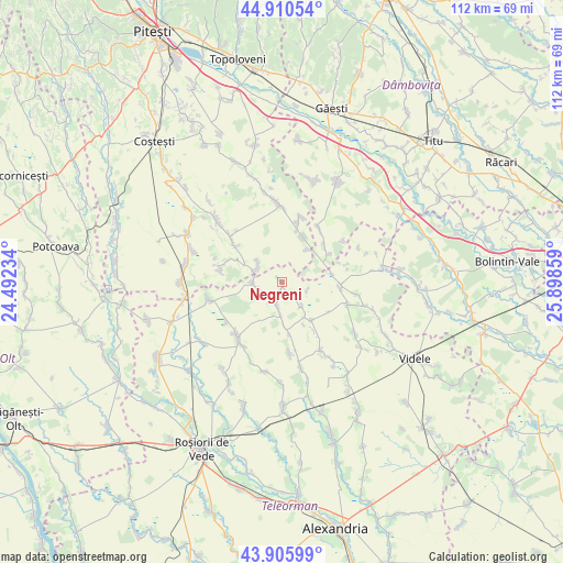
Negreni GPS coordinates[2]
44° 24' 37.512" North, 25° 11' 43.656" East
| Map corner | latitude | longitude |
|---|---|---|
| Upper-left | 44.91054°, | 24.49234° |
| Center: | 44.41042°, | 25.19546° |
| Lower-right: | 43.90599°, | 25.89859° |
| Map W x H: | 111.7×111.7 km | = 69.4×69.4mi |
| max Lat: | 48.23793° ⇑87.9% North |
| Negreni: | 44.41042° |
| min Lat: | ⇓12.1% South 43.65638° |
| min Long | Negreni | max Long |
| 20.31667° | 25.19546° | 29.65403° |
| W 49.9%⇐ | ⇒50.1% E |
Elevation
Elevation of Negreni is 147 m = 482 ft, and this is 107.9 m = 354 ft below average elevation for this country.
| Max E: |
1278 m = 4193 ft | 64.9% |
| Avg. | 254.9 m = 836 ft | |
| Negreni | 147 m = 482 ft | |
Min E: |
-2 m = -7 ft | 35.1% |
See also: Romania elevation on elevation.city.
Geographical zone
Negreni is located in North temperate zone (between Tropic of Cancer and the Arctic Circle). Distance of this Northern Tropic circle is 2332.1 km =1449.1 mi to South.| Distance of | km | miles | from Negreni |
|---|---|---|---|
| North Pole | 5069.1 | 3149.8 | to North |
| Arctic Circle | 2463.2 | 1530.6 | to North |
| Tropic Cancer | 2332.1 | 1449.1 | to South |
| Equator | 4938 | 3068.3 | to South |


Nearby cities:
15 places around Negreni: (largest is in red/bold)
• Dobreni
6.3 km =3.9 mi,  276°
276°
• Drăcești
6.1 km =3.8 mi,  140°
140°
• Negrenii de Sus
1.2 km =0.7 mi,  323°
323°
• Poeni
11 km =6.8 mi,  96°
96°
• Popeşti
8.3 km =5.2 mi,  294°
294°
• Poporogi
5 km =3.1 mi,  191°
191°
• Purcăreni
6.3 km =3.9 mi,  310°
310°
• Scurtu Mare
8.8 km =5.5 mi, 139°
• Slobozia
5.9 km =3.7 mi,  297°
297°
• Slăvești
7.7 km =4.8 mi,  178°
178°
• Tătărăștii de Jos
4.2 km =2.6 mi,  200°
200°
• Tătărăștii de Sus
5.8 km =3.6 mi,  267°
267°
• Udupu
4.3 km =2.7 mi,  249°
249°
• Şelaru
11.1 km =6.9 mi,  48°
48°
• Ştefan cel Mare
9.9 km =6.2 mi,  22°
22°
Sources, notices
• [Note1] Compared only with cities in Romania existing in our database
• [Src1] Map data: © OpenStreetMap contributors (CC-BY-SA)
• [Src2] Other city data from geonames.org with taken over terms of usage.
• [Src3] Geographical zone / Annual Mean Temperature by Robert A. Rohde @ Wikipedia
