Seaca de Pădure geodata
Seaca de Pădure (Dolj) is a seat of a second-order administrative division; located in Romania in Europe/Bucharest (GMT+3) time zone. With population of 699 people, there are 5579 cities with bigger population in this country. Compared to other cities in Romania, 89.2% of cities are located further ↑North; 79.9% of cities are located further →East and 51.5% of cities have lower elevation than Seaca de Pădure. Note1


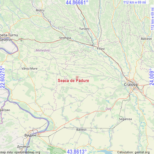
Seaca de Pădure GPS coordinates[2]
44° 21' 57.996" North, 23° 18' 21.132" East
| Map corner | latitude | longitude |
|---|---|---|
| Upper-left | 44.86661°, | 22.60275° |
| Center: | 44.36611°, | 23.30587° |
| Lower-right: | 43.8613°, | 24.009° |
| Map W x H: | 111.8×111.8 km | = 69.5×69.5mi |
| max Lat: | 48.23793° ⇑89.2% North |
| Seaca de Pădure: | 44.36611° |
| min Lat: | ⇓10.8% South 43.65638° |
| min Long | Seaca de Pădur | max Long |
| 20.31667° | 23.30587° | 29.65403° |
| W 20.1%⇐ | ⇒79.9% E |
Elevation
Elevation of Seaca de Pădure is 219 m = 719 ft, and this is 35.9 m = 118 ft below average elevation for this country.
| Max E: |
1278 m = 4193 ft | 48.5% |
| Avg. | 254.9 m = 836 ft | |
| Seaca de Pădure | 219 m = 719 ft | |
Min E: |
-2 m = -7 ft | 51.5% |
See also: Romania elevation on elevation.city.
Geographical zone
Seaca de Pădure is located in North temperate zone (between Tropic of Cancer and the Arctic Circle). Distance of this Northern Tropic circle is 2327.1 km =1446 mi to South.| Distance of | km | miles | from Seaca de Pădure |
|---|---|---|---|
| North Pole | 5074 | 3152.8 | to North |
| Arctic Circle | 2468.1 | 1533.6 | to North |
| Tropic Cancer | 2327.1 | 1446 | to South |
| Equator | 4933 | 3065.2 | to South |


Nearby cities:
15 places around Seaca de Pădure: (largest is in red/bold)
• Botoşeşti-Paia
4.9 km =3 mi,  320°
320°
• Brabova
10.1 km =6.3 mi,  89°
89°
• Bucovicior
8.4 km =5.2 mi,  153°
153°
• Bărboi
9 km =5.6 mi,  8°
8°
• Carpen
5.7 km =3.5 mi,  230°
230°
• Cleanov
7.7 km =4.8 mi,  259°
259°
• Căciulatu
10.8 km =6.7 mi,  122°
122°
• Călugărei
8.9 km =5.5 mi,  206°
206°
• Gogoşu
7.4 km =4.6 mi,  40°
40°
• Greceşti
9.5 km =5.9 mi,  349°
349°
• Gubaucea
10 km =6.2 mi,  162°
162°
• Răchita de Jos
8.2 km =5.1 mi,  105°
105°
• Urdinița
9.9 km =6.2 mi,  75°
75°
• Veleni
1.8 km =1.1 mi,  0°
0°
• Țiu
10.7 km =6.6 mi,  34°
34°
Sources, notices
• [Note1] Compared only with cities in Romania existing in our database
• [Src1] Map data: © OpenStreetMap contributors (CC-BY-SA)
• [Src2] Other city data from geonames.org with taken over terms of usage.
• [Src3] Geographical zone / Annual Mean Temperature by Robert A. Rohde @ Wikipedia
