Sarasău geodata
Sarasău (Maramureş) is a seat of a second-order administrative division; located in Romania in Europe/Bucharest (GMT+3) time zone. With population of 2,444 people, there are 2206 cities with bigger population in this country. Compared to other cities in Romania, 98.8% of cities are located further ↓South; 72.1% of cities are located further →East and 58.9% of cities have lower elevation than Sarasău. Note1


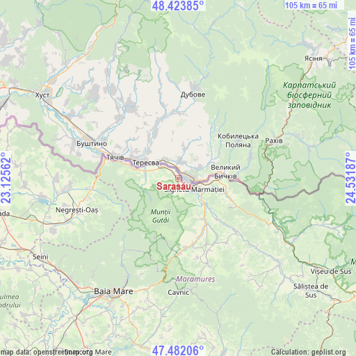
Sarasău GPS coordinates[2]
47° 57' 18.36" North, 23° 49' 43.464" East
| Map corner | latitude | longitude |
|---|---|---|
| Upper-left | 48.42385°, | 23.12562° |
| Center: | 47.9551°, | 23.82874° |
| Lower-right: | 47.48206°, | 24.53187° |
| Map W x H: | 104.7×104.7 km | = 65.1×65.1mi |
| max Lat: | 48.23793° ⇑1.2% North |
| Sarasău: | 47.9551° |
| min Lat: | ⇓98.8% South 43.65638° |
| min Long | Sarasău | max Long |
| 20.31667° | 23.82874° | 29.65403° |
| W 27.9%⇐ | ⇒72.1% E |
Elevation
Elevation of Sarasău is 257 m = 843 ft, and this is 2.1 m = 7 ft above average elevation for this country.
| Max E: |
1278 m = 4193 ft | 41.1% |
| Sarasău | 257 m 843 ft | |
| Avg. | 254.9 m = 836 ft | |
Min E: |
-2 m = -7 ft | 58.9% |
See also: Romania elevation on elevation.city.
Geographical zone
Sarasău is located in North temperate zone (between Tropic of Cancer and the Arctic Circle). Distance of this North polar circle is 2069.1 km =1285.7 mi to North.| Distance of | km | miles | from Sarasău |
|---|---|---|---|
| North Pole | 4675 | 2904.9 | to North |
| Arctic Circle | 2069.1 | 1285.7 | to North |
| Tropic Cancer | 2726.2 | 1694 | to South |
| Equator | 5332.1 | 3313.2 | to South |


Nearby cities:
15 places around Sarasău: (largest is in red/bold)
• Berbești
14.2 km =8.8 mi,  146°
146°
• Bocicoiu Mare
12.8 km =8 mi,  84°
84°
• Crăciunești
11.5 km =7.1 mi,  89°
89°
• Câmpulung la Tisa
5.4 km =3.4 mi,  309°
309°
• Iapa
3.3 km =2.1 mi,  184°
184°
• Lazu Baciului
8.8 km =5.5 mi,  129°
129°
• Remeţi
14.9 km =9.3 mi,  282°
282°
• Rona de Jos
14.6 km =9.1 mi,  106°
106°
• Sighetu Marmaţiei
5 km =3.1 mi,  121°
121°
• Săpânţa
9.7 km =6 mi, 277°
• Tisa
9.6 km =6 mi, 94°
• Vadu Izei
4.7 km =2.9 mi, 120°
• Vadu Izei
10.7 km =6.6 mi, 134°
• Valea Cufundoasă
8.8 km =5.5 mi,  103°
103°
• Valea Stejarului
15 km =9.3 mi, 126°
Sources, notices
• [Note1] Compared only with cities in Romania existing in our database
• [Src1] Map data: © OpenStreetMap contributors (CC-BY-SA)
• [Src2] Other city data from geonames.org with taken over terms of usage.
• [Src3] Geographical zone / Annual Mean Temperature by Robert A. Rohde @ Wikipedia
