Câmpulung la Tisa geodata
Câmpulung la Tisa (Maramureş) is a seat of a second-order administrative division; located in Romania in Europe/Bucharest (GMT+3) time zone. With population of 2,498 people, there are 2164 cities with bigger population in this country. Compared to other cities in Romania, 99.1% of cities are located further ↓South; 72.9% of cities are located further →East and 56.2% of cities have lower elevation than Câmpulung la Tisa. Note1


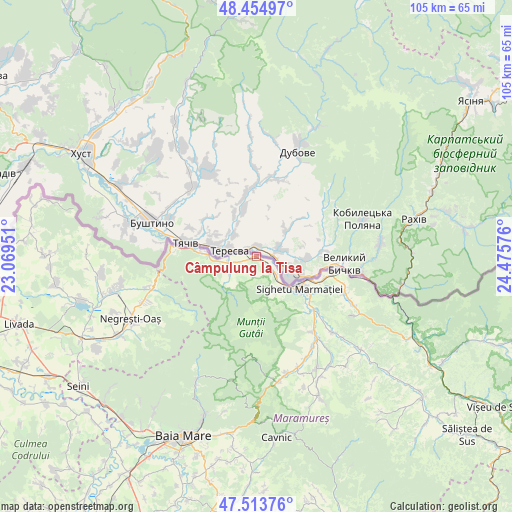
Câmpulung la Tisa GPS coordinates[2]
47° 59' 11.436" North, 23° 46' 21.468" East
| Map corner | latitude | longitude |
|---|---|---|
| Upper-left | 48.45497°, | 23.06951° |
| Center: | 47.98651°, | 23.77263° |
| Lower-right: | 47.51376°, | 24.47576° |
| Map W x H: | 104.7×104.7 km | = 65.1×65.1mi |
| max Lat: | 48.23793° ⇑0.9% North |
| Câmpulung la Tisa: | 47.98651° |
| min Lat: | ⇓99.1% South 43.65638° |
| min Long | Câmpulung la T | max Long |
| 20.31667° | 23.77263° | 29.65403° |
| W 27.1%⇐ | ⇒72.9% E |
Elevation
Elevation of Câmpulung la Tisa is 244 m = 801 ft, and this is 10.9 m = 36 ft below average elevation for this country.
| Max E: |
1278 m = 4193 ft | 43.8% |
| Avg. | 254.9 m = 836 ft | |
| Câmpulung la Tisa | 244 m = 801 ft | |
Min E: |
-2 m = -7 ft | 56.2% |
See also: Romania elevation on elevation.city.
Geographical zone
Câmpulung la Tisa is located in North temperate zone (between Tropic of Cancer and the Arctic Circle). Distance of this North polar circle is 2065.6 km =1283.5 mi to North.| Distance of | km | miles | from Câmpulung la Tisa |
|---|---|---|---|
| North Pole | 4671.5 | 2902.7 | to North |
| Arctic Circle | 2065.6 | 1283.5 | to North |
| Tropic Cancer | 2729.7 | 1696.2 | to South |
| Equator | 5335.6 | 3315.4 | to South |


Nearby cities:
15 places around Câmpulung la Tisa: (largest is in red/bold)
• Berbești
19.5 km =12.1 mi,  141°
141°
• Bocicoiu Mare
17.1 km =10.6 mi,  97°
97°
• Crăciunești
16 km =9.9 mi, 102°
• Iapa
7.9 km =4.9 mi,  150°
150°
• Lazu Baciului
14.3 km =8.9 mi,  129°
129°
• Remeţi
10.4 km =6.5 mi,  268°
268°
• Rona de Jos
19.8 km =12.3 mi,  113°
113°
• Sarasău
5.4 km =3.4 mi, 129°
• Sighetu Marmaţiei
10.4 km =6.5 mi, 125°
• Săpânţa
5.8 km =3.6 mi,  247°
247°
• Tisa
14.4 km =8.9 mi, 107°
• Vadu Izei
10.1 km =6.3 mi, 125°
• Vadu Izei
16.1 km =10 mi, 132°
• Valea Cufundoasă
13.9 km =8.6 mi, 113°
• Valea Stejarului
20.4 km =12.7 mi, 127°
Sources, notices
• [Note1] Compared only with cities in Romania existing in our database
• [Src1] Map data: © OpenStreetMap contributors (CC-BY-SA)
• [Src2] Other city data from geonames.org with taken over terms of usage.
• [Src3] Geographical zone / Annual Mean Temperature by Robert A. Rohde @ Wikipedia
