Salcia Tudor geodata
Salcia Tudor (Brăila) is a seat of a second-order administrative division; located in Romania in Europe/Bucharest (GMT+3) time zone. With population of 3,017 people, there are 1749 cities with bigger population in this country. Compared to other cities in Romania, 57.6% of cities are located further ↑North; 91% of cities are located further ←West and 97.9% of cities have higher elevation than Salcia Tudor. Note1


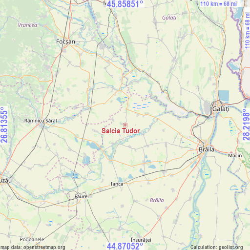
Salcia Tudor GPS coordinates[2]
45° 22' 0.012" North, 27° 31' 0.012" East
| Map corner | latitude | longitude |
|---|---|---|
| Upper-left | 45.85851°, | 26.81355° |
| Center: | 45.36667°, | 27.51667° |
| Lower-right: | 44.87052°, | 28.2198° |
| Map W x H: | 109.9×109.9 km | = 68.3×68.3mi |
| max Lat: | 48.23793° ⇑57.6% North |
| Salcia Tudor: | 45.36667° |
| min Lat: | ⇓42.4% South 43.65638° |
| min Long | Salcia Tudor | max Long |
| 20.31667° | 27.51667° | 29.65403° |
| W 91%⇐ | ⇒9% E |
Elevation
Elevation of Salcia Tudor is 18 m = 59 ft, and this is 236.9 m = 777 ft below average elevation for this country.
| Max E: |
1278 m = 4193 ft | 97.9% |
| Avg. | 254.9 m = 836 ft | |
| Salcia Tudor | 18 m = 59 ft | |
Min E: |
-2 m = -7 ft | 2.1% |
See also: Romania elevation on elevation.city.
Geographical zone
Salcia Tudor is located in North temperate zone (between Tropic of Cancer and the Arctic Circle). Distance of this North polar circle is 2356.9 km =1464.5 mi to North.| Distance of | km | miles | from Salcia Tudor |
|---|---|---|---|
| North Pole | 4962.8 | 3083.7 | to North |
| Arctic Circle | 2356.9 | 1464.5 | to North |
| Tropic Cancer | 2438.4 | 1515.2 | to South |
| Equator | 5044.3 | 3134.4 | to South |


Nearby cities:
15 places around Salcia Tudor: (largest is in red/bold)
• Băile
14.8 km =9.2 mi,  234°
234°
• Corbu Nou
7.6 km =4.7 mi,  50°
50°
• Cuza Vodă
5.9 km =3.7 mi,  296°
296°
• Gemenele
12.1 km =7.5 mi,  139°
139°
• Grădiştea
15.2 km =9.4 mi,  223°
223°
• Gulianca
7.2 km =4.5 mi,  3°
3°
• Ibrianu
16.9 km =10.5 mi, 218°
• Latinu
14.5 km =9 mi,  79°
79°
• Măicăneşti
14.9 km =9.3 mi,  354°
354°
• Măxineni
9.8 km =6.1 mi,  67°
67°
• Racoviţa
9.1 km =5.7 mi, 215°
• Râmnicelu
9.4 km =5.8 mi,  171°
171°
• Scorţaru Nou
8.6 km =5.3 mi,  130°
130°
• Tătaru
15.4 km =9.6 mi, 347°
• Vâlcelele
13.3 km =8.3 mi,  259°
259°
Sources, notices
• [Note1] Compared only with cities in Romania existing in our database
• [Src1] Map data: © OpenStreetMap contributors (CC-BY-SA)
• [Src2] Other city data from geonames.org with taken over terms of usage.
• [Src3] Geographical zone / Annual Mean Temperature by Robert A. Rohde @ Wikipedia
