Salcia geodata
Salcia (Teleorman) is a seat of a second-order administrative division; located in Romania in Europe/Bucharest (GMT+3) time zone. With population of 3,243 people, there are 1591 cities with bigger population in this country. Compared to other cities in Romania, 97.7% of cities are located further ↑North; 53.8% of cities are located further →East and 89.5% of cities have higher elevation than Salcia. Note1


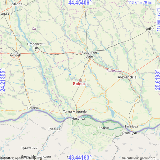
Salcia GPS coordinates[2]
43° 57' 0" North, 24° 55' 0.012" East
| Map corner | latitude | longitude |
|---|---|---|
| Upper-left | 44.45406°, | 24.21355° |
| Center: | 43.95°, | 24.91667° |
| Lower-right: | 43.44163°, | 25.6198° |
| Map W x H: | 112.6×112.6 km | = 70×70mi |
| max Lat: | 48.23793° ⇑97.7% North |
| Salcia: | 43.95° |
| min Lat: | ⇓2.3% South 43.65638° |
| min Long | Salcia | max Long |
| 20.31667° | 24.91667° | 29.65403° |
| W 46.2%⇐ | ⇒53.8% E |
Elevation
Elevation of Salcia is 60 m = 197 ft, and this is 194.9 m = 639 ft below average elevation for this country.
| Max E: |
1278 m = 4193 ft | 89.5% |
| Avg. | 254.9 m = 836 ft | |
| Salcia | 60 m = 197 ft | |
Min E: |
-2 m = -7 ft | 10.5% |
See also: Romania elevation on elevation.city.
Geographical zone
Salcia is located in North temperate zone (between Tropic of Cancer and the Arctic Circle). Distance of this Northern Tropic circle is 2280.9 km =1417.3 mi to South.| Distance of | km | miles | from Salcia |
|---|---|---|---|
| North Pole | 5120.3 | 3181.6 | to North |
| Arctic Circle | 2514.4 | 1562.4 | to North |
| Tropic Cancer | 2280.9 | 1417.3 | to South |
| Equator | 4886.8 | 3036.5 | to South |


Nearby cities:
15 places around Salcia: (largest is in red/bold)
• Balta Sărată
10.2 km =6.3 mi,  314°
314°
• Bogdana
13.5 km =8.4 mi,  97°
97°
• Băduleasa
6.1 km =3.8 mi,  119°
119°
• Băneasa
2.9 km =1.8 mi,  113°
113°
• Caravaneți
3.3 km =2.1 mi,  280°
280°
• Cârlomanu
5.1 km =3.2 mi,  137°
137°
• Călmăţuiu
4.4 km =2.7 mi,  294°
294°
• Călmățuiu de Sus
11.9 km =7.4 mi,  315°
315°
• Dorobanțu
8.6 km =5.3 mi,  303°
303°
• Ionașcu
13.1 km =8.1 mi, 322°
• Nicolae Bălcescu
6.9 km =4.3 mi, 279°
• Putineiu
6.9 km =4.3 mi, 144°
• Troianul
8.7 km =5.4 mi,  50°
50°
• Tudor Vladimirescu
0.9 km =0.6 mi,  252°
252°
• Urluiu
11 km =6.8 mi,  87°
87°
Sources, notices
• [Note1] Compared only with cities in Romania existing in our database
• [Src1] Map data: © OpenStreetMap contributors (CC-BY-SA)
• [Src2] Other city data from geonames.org with taken over terms of usage.
• [Src3] Geographical zone / Annual Mean Temperature by Robert A. Rohde @ Wikipedia
