Rogojeni geodata
Rogojeni (Galaţi) is a populated place; located in Romania in Europe/Bucharest (GMT+3) time zone. With population of 655 people, there are 5856 cities with bigger population in this country. Compared to other cities in Romania, 54.7% of cities are located further ↓South; 97.1% of cities are located further ←West and 97% of cities have higher elevation than Rogojeni. Note1


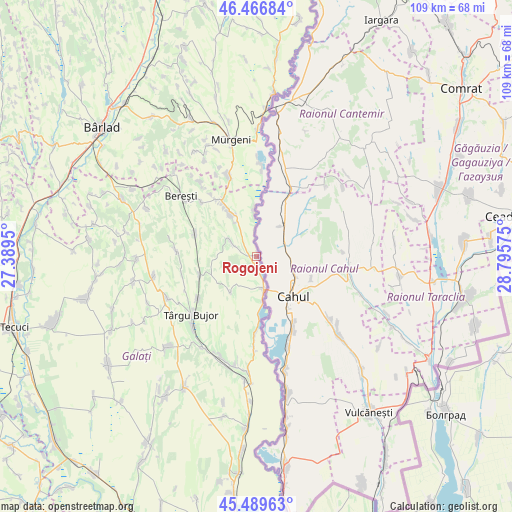
Rogojeni GPS coordinates[2]
45° 58' 49.404" North, 28° 5' 33.432" East
| Map corner | latitude | longitude |
|---|---|---|
| Upper-left | 46.46684°, | 27.3895° |
| Center: | 45.98039°, | 28.09262° |
| Lower-right: | 45.48963°, | 28.79575° |
| Map W x H: | 108.7×108.7 km | = 67.5×67.5mi |
| max Lat: | 48.23793° ⇑45.3% North |
| Rogojeni: | 45.98039° |
| min Lat: | ⇓54.7% South 43.65638° |
| min Long | Rogojeni | max Long |
| 20.31667° | 28.09262° | 29.65403° |
| W 97.1%⇐ | ⇒2.9% E |
Elevation
Elevation of Rogojeni is 23 m = 75 ft, and this is 231.9 m = 761 ft below average elevation for this country.
| Max E: |
1278 m = 4193 ft | 97% |
| Avg. | 254.9 m = 836 ft | |
| Rogojeni | 23 m = 75 ft | |
Min E: |
-2 m = -7 ft | 3% |
See also: Romania elevation on elevation.city.
Geographical zone
Rogojeni is located in North temperate zone (between Tropic of Cancer and the Arctic Circle). Distance of this North polar circle is 2288.6 km =1422.1 mi to North.| Distance of | km | miles | from Rogojeni |
|---|---|---|---|
| North Pole | 4894.5 | 3041.3 | to North |
| Arctic Circle | 2288.6 | 1422.1 | to North |
| Tropic Cancer | 2506.6 | 1557.5 | to South |
| Equator | 5112.5 | 3176.8 | to South |


Nearby cities:
15 places around Rogojeni: (largest is in red/bold)
• Balintești
14.3 km =8.9 mi,  292°
292°
• Berești-Meria
18.8 km =11.7 mi,  308°
308°
• Blăgeşti
18.5 km =11.5 mi,  340°
340°
• Băneasa
13.4 km =8.3 mi,  246°
246°
• Cavadineşti
11.2 km =7 mi,  328°
328°
• Cârja
18.8 km =11.7 mi,  4°
4°
• Gănești
14.4 km =8.9 mi, 327°
• Jorăşti
17.5 km =10.9 mi,  271°
271°
• Moscu
15.2 km =9.4 mi,  235°
235°
• Oancea
7.1 km =4.4 mi,  175°
175°
• Roșcani
9.2 km =5.7 mi,  215°
215°
• Slivna
16.4 km =10.2 mi, 314°
• Suceveni
6.8 km =4.2 mi,  301°
301°
• Vlădeşti
14.5 km =9 mi, 182°
• Vădeni
9.6 km =6 mi,  357°
357°
Sources, notices
• [Note1] Compared only with cities in Romania existing in our database
• [Src1] Map data: © OpenStreetMap contributors (CC-BY-SA)
• [Src2] Other city data from geonames.org with taken over terms of usage.
• [Src3] Geographical zone / Annual Mean Temperature by Robert A. Rohde @ Wikipedia
