Gârlenii de Sus geodata
Gârlenii de Sus (Bacău) is a seat of a second-order administrative division; located in Romania in Europe/Bucharest (GMT+3) time zone. With population of 1,626 people, there are 3010 cities with bigger population in this country. Compared to other cities in Romania, 70.7% of cities are located further ↓South; 78.6% of cities are located further ←West and 54.8% of cities have higher elevation than Gârlenii de Sus. Note1


Gârlenii de Sus GPS coordinates[2]
46° 39' 14.904" North, 26° 47' 41.676" East
| Map corner | latitude | longitude |
|---|---|---|
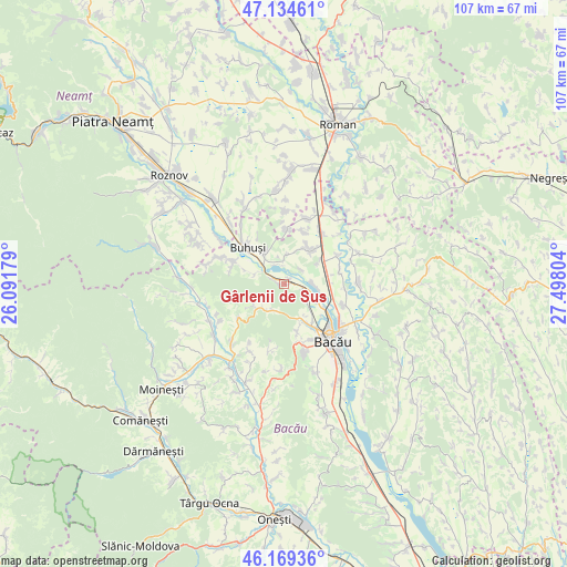
| Upper-left | 47.13461°, | 26.09179° |
| Center: | 46.65414°, | 26.79491° |
| Lower-right: | 46.16936°, | 27.49804° |
| Map W x H: | 107.3×107.3 km | = 66.7×66.7mi |
| max Lat: | 48.23793° ⇑29.3% North |
| Gârlenii de Sus: | 46.65414° |
| min Lat: | ⇓70.7% South 43.65638° |
| min Long | Gârlenii de Su | max Long |
| 20.31667° | 26.79491° | 29.65403° |
| W 78.6%⇐ | ⇒21.4% E |
Elevation
Elevation of Gârlenii de Sus is 188 m = 617 ft, and this is 66.9 m = 219 ft below average elevation for this country.
| Max E: |
1278 m = 4193 ft | 54.8% |
| Avg. | 254.9 m = 836 ft | |
| Gârlenii de Sus | 188 m = 617 ft | |
Min E: |
-2 m = -7 ft | 45.2% |
See also: Romania elevation on elevation.city.
Geographical zone
Gârlenii de Sus is located in North temperate zone (between Tropic of Cancer and the Arctic Circle). Distance of this North polar circle is 2213.7 km =1375.5 mi to North.| Distance of | km | miles | from Gârlenii de Sus |
|---|---|---|---|
| North Pole | 4819.6 | 2994.8 | to North |
| Arctic Circle | 2213.7 | 1375.5 | to North |
| Tropic Cancer | 2581.5 | 1604.1 | to South |
| Equator | 5187.5 | 3223.4 | to South |


Nearby cities:
15 places around Gârlenii de Sus: (largest is in red/bold)
• Bereşti-Bistriţa
7.5 km =4.7 mi,  22°
22°
• Buda
6.1 km =3.8 mi,  288°
288°
• Buhuşi
10 km =6.2 mi,  313°
313°
• Galbeni
10.5 km =6.5 mi, 20°
• Gura Văii
3.5 km =2.2 mi,  0°
0°
• Gârleni
1.4 km =0.9 mi, 15°
• Hemeiuș
5.5 km =3.4 mi,  124°
124°
• Iteşti
5.9 km =3.7 mi,  91°
91°
• Izvoare
10.3 km =6.4 mi, 3°
• Lespezi
2.3 km =1.4 mi,  301°
301°
• Lilieci
6.5 km =4 mi, 115°
• Luncani
5.6 km =3.5 mi,  206°
206°
• Mărgineni
8.5 km =5.3 mi,  149°
149°
• Mărgineni-Munteni
10 km =6.2 mi,  126°
126°
• Racova
6.1 km =3.8 mi,  326°
326°
Sources, notices
• [Note1] Compared only with cities in Romania existing in our database
• [Src1] Map data: © OpenStreetMap contributors (CC-BY-SA)
• [Src2] Other city data from geonames.org with taken over terms of usage.
• [Src3] Geographical zone / Annual Mean Temperature by Robert A. Rohde @ Wikipedia
