Mărgineni-Munteni geodata
Mărgineni-Munteni (Bacău) is a populated place; located in Romania in Europe/Bucharest (GMT+3) time zone. With population of 8,033 people, there are 309 cities with bigger population in this country. Compared to other cities in Romania, 69.4% of cities are located further ↓South; 80.9% of cities are located further ←West and 60.6% of cities have higher elevation than Mărgineni-Munteni. Note1


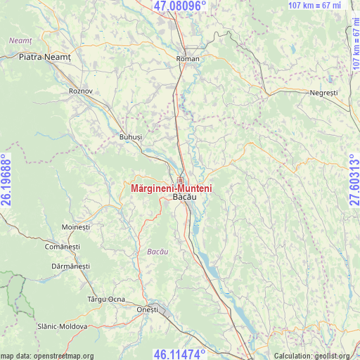
Mărgineni-Munteni GPS coordinates[2]
46° 36' 0" North, 26° 54' 0" East
| Map corner | latitude | longitude |
|---|---|---|
| Upper-left | 47.08096°, | 26.19688° |
| Center: | 46.6°, | 26.9° |
| Lower-right: | 46.11474°, | 27.60313° |
| Map W x H: | 107.4×107.4 km | = 66.7×66.7mi |
| max Lat: | 48.23793° ⇑30.6% North |
| Mărgineni-Munteni: | 46.6° |
| min Lat: | ⇓69.4% South 43.65638° |
| min Long | Mărgineni-Munt | max Long |
| 20.31667° | 26.9° | 29.65403° |
| W 80.9%⇐ | ⇒19.1% E |
Elevation
Elevation of Mărgineni-Munteni is 164 m = 538 ft, and this is 90.9 m = 298 ft below average elevation for this country.
| Max E: |
1278 m = 4193 ft | 60.6% |
| Avg. | 254.9 m = 836 ft | |
| Mărgineni-Munteni | 164 m = 538 ft | |
Min E: |
-2 m = -7 ft | 39.4% |
See also: Romania elevation on elevation.city.
Geographical zone
Mărgineni-Munteni is located in North temperate zone (between Tropic of Cancer and the Arctic Circle). Distance of this North polar circle is 2219.7 km =1379.3 mi to North.| Distance of | km | miles | from Mărgineni-Munteni |
|---|---|---|---|
| North Pole | 4825.6 | 2998.5 | to North |
| Arctic Circle | 2219.7 | 1379.3 | to North |
| Tropic Cancer | 2575.5 | 1600.3 | to South |
| Equator | 5181.4 | 3219.6 | to South |


Nearby cities:
15 places around Mărgineni-Munteni: (largest is in red/bold)
• Bacău
3.8 km =2.4 mi,  163°
163°
• Barați
3.5 km =2.2 mi,  219°
219°
• Hemeiuș
4.6 km =2.9 mi,  310°
310°
• Holt
6.2 km =3.9 mi,  112°
112°
• Iteşti
6.3 km =3.9 mi,  340°
340°
• Letea Veche
6.7 km =4.2 mi,  145°
145°
• Lilieci
3.8 km =2.4 mi,  325°
325°
• Luizi-Călugăra
9 km =5.6 mi,  214°
214°
• Măgura
5.3 km =3.3 mi,  225°
225°
• Mărgineni
4 km =2.5 mi,  249°
249°
• Osebiți
8.3 km =5.2 mi, 214°
• Prăjești
8.4 km =5.2 mi,  43°
43°
• Schineni
6 km =3.7 mi, 38°
• Siretu
8.3 km =5.2 mi,  16°
16°
• Săucești
3.8 km =2.4 mi,  56°
56°
Sources, notices
• [Note1] Compared only with cities in Romania existing in our database
• [Src1] Map data: © OpenStreetMap contributors (CC-BY-SA)
• [Src2] Other city data from geonames.org with taken over terms of usage.
• [Src3] Geographical zone / Annual Mean Temperature by Robert A. Rohde @ Wikipedia
