Răcăciuni geodata
Răcăciuni (Bacău) is a seat of a second-order administrative division; located in Romania in Europe/Bucharest (GMT+3) time zone. With population of 7,839 people, there are 325 cities with bigger population in this country. Compared to other cities in Romania, 62.9% of cities are located further ↓South; 82.6% of cities are located further ←West and 50.8% of cities have lower elevation than Răcăciuni. Note1


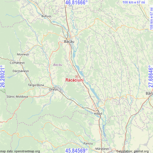
Răcăciuni GPS coordinates[2]
46° 19' 59.988" North, 26° 58' 59.988" East
| Map corner | latitude | longitude |
|---|---|---|
| Upper-left | 46.81666°, | 26.28021° |
| Center: | 46.33333°, | 26.98333° |
| Lower-right: | 45.84569°, | 27.68646° |
| Map W x H: | 108×108 km | = 67.1×67.1mi |
| max Lat: | 48.23793° ⇑37.1% North |
| Răcăciuni: | 46.33333° |
| min Lat: | ⇓62.9% South 43.65638° |
| min Long | Răcăciuni | max Long |
| 20.31667° | 26.98333° | 29.65403° |
| W 82.6%⇐ | ⇒17.4% E |
Elevation
Elevation of Răcăciuni is 216 m = 709 ft, and this is 38.9 m = 128 ft below average elevation for this country.
| Max E: |
1278 m = 4193 ft | 49.2% |
| Avg. | 254.9 m = 836 ft | |
| Răcăciuni | 216 m = 709 ft | |
Min E: |
-2 m = -7 ft | 50.8% |
See also: Romania elevation on elevation.city.
Geographical zone
Răcăciuni is located in North temperate zone (between Tropic of Cancer and the Arctic Circle). Distance of this North polar circle is 2249.4 km =1397.7 mi to North.| Distance of | km | miles | from Răcăciuni |
|---|---|---|---|
| North Pole | 4855.3 | 3016.9 | to North |
| Arctic Circle | 2249.4 | 1397.7 | to North |
| Tropic Cancer | 2545.9 | 1581.9 | to South |
| Equator | 5151.8 | 3201.2 | to South |


Nearby cities:
15 places around Răcăciuni: (largest is in red/bold)
• Bazga
6 km =3.7 mi,  30°
30°
• Ciucani
5.3 km =3.3 mi,  314°
314°
• Dieneț
6.7 km =4.2 mi,  106°
106°
• Drăgușani
3.9 km =2.4 mi,  176°
176°
• Dumbrava
7.6 km =4.7 mi,  249°
249°
• Fundu Răcăciuni
7.7 km =4.8 mi,  291°
291°
• Gheorghe Doja
5.3 km =3.3 mi,  342°
342°
• Orbeni
6.1 km =3.8 mi,  155°
155°
• Parava
3.9 km =2.4 mi, 160°
• Păltinata
9.3 km =5.8 mi,  234°
234°
• Pănceşti
7.7 km =4.8 mi,  90°
90°
• Recea
8.5 km =5.3 mi,  40°
40°
• Rădoaia
5 km =3.1 mi,  237°
237°
• Scurta
8.4 km =5.2 mi, 162°
• Valea Mică
7.1 km =4.4 mi, 335°
Sources, notices
• [Note1] Compared only with cities in Romania existing in our database
• [Src1] Map data: © OpenStreetMap contributors (CC-BY-SA)
• [Src2] Other city data from geonames.org with taken over terms of usage.
• [Src3] Geographical zone / Annual Mean Temperature by Robert A. Rohde @ Wikipedia
