Potigrafu geodata
Potigrafu (Prahova) is a populated place; located in Romania in Europe/Bucharest (GMT+3) time zone. With population of 1,462 people, there are 3244 cities with bigger population in this country. Compared to other cities in Romania, 77.1% of cities are located further ↑North; 65% of cities are located further ←West and 75.9% of cities have higher elevation than Potigrafu. Note1


Potigrafu GPS coordinates[2]
44° 47' 6.144" North, 26° 6' 0.504" East
| Map corner | latitude | longitude |
|---|---|---|
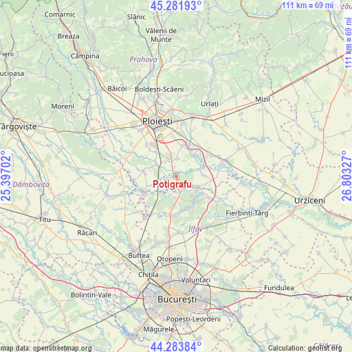
| Upper-left | 45.28193°, | 25.39702° |
| Center: | 44.78504°, | 26.10014° |
| Lower-right: | 44.28384°, | 26.80327° |
| Map W x H: | 111×111 km | = 69×69mi |
| max Lat: | 48.23793° ⇑77.1% North |
| Potigrafu: | 44.78504° |
| min Lat: | ⇓22.9% South 43.65638° |
| min Long | Potigrafu | max Long |
| 20.31667° | 26.10014° | 29.65403° |
| W 65%⇐ | ⇒35% E |
Elevation
Elevation of Potigrafu is 107 m = 351 ft, and this is 147.9 m = 485 ft below average elevation for this country.
| Max E: |
1278 m = 4193 ft | 75.9% |
| Avg. | 254.9 m = 836 ft | |
| Potigrafu | 107 m = 351 ft | |
Min E: |
-2 m = -7 ft | 24.1% |
See also: Romania elevation on elevation.city.
Geographical zone
Potigrafu is located in North temperate zone (between Tropic of Cancer and the Arctic Circle). Distance of this Northern Tropic circle is 2373.7 km =1474.9 mi to South.| Distance of | km | miles | from Potigrafu |
|---|---|---|---|
| North Pole | 5027.4 | 3123.9 | to North |
| Arctic Circle | 2421.5 | 1504.6 | to North |
| Tropic Cancer | 2373.7 | 1474.9 | to South |
| Equator | 4979.6 | 3094.2 | to South |


Nearby cities:
15 places around Potigrafu: (largest is in red/bold)
• Balta Doamnei
6.5 km =4 mi,  126°
126°
• Ciolpani
5.9 km =3.7 mi,  192°
192°
• Crivina
3.5 km =2.2 mi,  272°
272°
• Curcubeu
4.3 km =2.7 mi, 125°
• Gorgota
1.3 km =0.8 mi,  261°
261°
• Miroslăvești
2.3 km =1.4 mi,  333°
333°
• Moara
6 km =3.7 mi,  335°
335°
• Odăile
5.5 km =3.4 mi,  323°
323°
• Pietroșani
6.1 km =3.8 mi,  2°
2°
• Piscu
6 km =3.7 mi,  201°
201°
• Poienarii Apostoli
3.9 km =2.4 mi,  248°
248°
• Poienarii-Rali
6.6 km =4.1 mi,  233°
233°
• Puchenii Mari
3.8 km =2.4 mi, 339°
• Puchenii Mici
6.2 km =3.9 mi, 321°
• Puchenii Moșneni
3.2 km =2 mi, 341°
Sources, notices
• [Note1] Compared only with cities in Romania existing in our database
• [Src1] Map data: © OpenStreetMap contributors (CC-BY-SA)
• [Src2] Other city data from geonames.org with taken over terms of usage.
• [Src3] Geographical zone / Annual Mean Temperature by Robert A. Rohde @ Wikipedia
