Gorgota geodata
Gorgota (Prahova) is a seat of a second-order administrative division; located in Romania in Europe/Bucharest (GMT+3) time zone. With population of 5,459 people, there are 645 cities with bigger population in this country. Compared to other cities in Romania, 77.4% of cities are located further ↑North; 64.7% of cities are located further ←West and 75.1% of cities have higher elevation than Gorgota. Note1


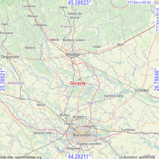
Gorgota GPS coordinates[2]
44° 46' 59.988" North, 26° 4' 59.988" East
| Map corner | latitude | longitude |
|---|---|---|
| Upper-left | 45.28023°, | 25.38021° |
| Center: | 44.78333°, | 26.08333° |
| Lower-right: | 44.28211°, | 26.78646° |
| Map W x H: | 111×111 km | = 69×69mi |
| max Lat: | 48.23793° ⇑77.4% North |
| Gorgota: | 44.78333° |
| min Lat: | ⇓22.6% South 43.65638° |
| min Long | Gorgota | max Long |
| 20.31667° | 26.08333° | 29.65403° |
| W 64.7%⇐ | ⇒35.3% E |
Elevation
Elevation of Gorgota is 110 m = 361 ft, and this is 144.9 m = 475 ft below average elevation for this country.
| Max E: |
1278 m = 4193 ft | 75.1% |
| Avg. | 254.9 m = 836 ft | |
| Gorgota | 110 m = 361 ft | |
Min E: |
-2 m = -7 ft | 24.9% |
See also: Romania elevation on elevation.city.
Geographical zone
Gorgota is located in North temperate zone (between Tropic of Cancer and the Arctic Circle). Distance of this Northern Tropic circle is 2373.5 km =1474.8 mi to South.| Distance of | km | miles | from Gorgota |
|---|---|---|---|
| North Pole | 5027.6 | 3124 | to North |
| Arctic Circle | 2421.7 | 1504.8 | to North |
| Tropic Cancer | 2373.5 | 1474.8 | to South |
| Equator | 4979.4 | 3094.1 | to South |


Nearby cities:
15 places around Gorgota: (largest is in red/bold)
• Ciolpani
5.6 km =3.5 mi,  180°
180°
• Crivina
2.2 km =1.4 mi,  278°
278°
• Curcubeu
5.3 km =3.3 mi,  115°
115°
• Miroslăvești
2.3 km =1.4 mi,  7°
7°
• Moara
5.7 km =3.5 mi,  348°
348°
• Odăile
5 km =3.1 mi,  336°
336°
• Piscu
5.5 km =3.4 mi,  189°
189°
• Poienarii Apostoli
2.6 km =1.6 mi,  241°
241°
• Poienarii Burchii
6.4 km =4 mi,  234°
234°
• Poienarii-Rali
5.4 km =3.4 mi, 226°
• Potigrafu
1.3 km =0.8 mi,  81°
81°
• Puchenii Mari
3.7 km =2.3 mi,  0°
0°
• Puchenii Mici
5.6 km =3.5 mi,  333°
333°
• Puchenii Moșneni
3.2 km =2 mi, 5°
• Tinosu
6.4 km =4 mi,  305°
305°
Sources, notices
• [Note1] Compared only with cities in Romania existing in our database
• [Src1] Map data: © OpenStreetMap contributors (CC-BY-SA)
• [Src2] Other city data from geonames.org with taken over terms of usage.
• [Src3] Geographical zone / Annual Mean Temperature by Robert A. Rohde @ Wikipedia
