Porumbești geodata
Porumbești (Satu Mare) is a seat of a second-order administrative division; located in Romania in Europe/Bucharest (GMT+3) time zone. With population of 1,560 people, there are 3101 cities with bigger population in this country. Compared to other cities in Romania, 99% of cities are located further ↓South; 84.7% of cities are located further →East and 70.6% of cities have higher elevation than Porumbești. Note1


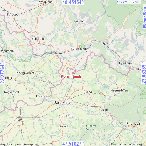
Porumbești GPS coordinates[2]
47° 58' 58.98" North, 22° 58' 50.736" East
| Map corner | latitude | longitude |
|---|---|---|
| Upper-left | 48.45154°, | 22.27764° |
| Center: | 47.98305°, | 22.98076° |
| Lower-right: | 47.51027°, | 23.68389° |
| Map W x H: | 104.7×104.7 km | = 65.1×65.1mi |
| max Lat: | 48.23793° ⇑1% North |
| Porumbești: | 47.98305° |
| min Lat: | ⇓99% South 43.65638° |
| min Long | Porumbești | max Long |
| 20.31667° | 22.98076° | 29.65403° |
| W 15.3%⇐ | ⇒84.7% E |
Elevation
Elevation of Porumbești is 125 m = 410 ft, and this is 129.9 m = 426 ft below average elevation for this country.
| Max E: |
1278 m = 4193 ft | 70.6% |
| Avg. | 254.9 m = 836 ft | |
| Porumbești | 125 m = 410 ft | |
Min E: |
-2 m = -7 ft | 29.4% |
See also: Romania elevation on elevation.city.
Geographical zone
Porumbești is located in North temperate zone (between Tropic of Cancer and the Arctic Circle). Distance of this North polar circle is 2066 km =1283.8 mi to North.| Distance of | km | miles | from Porumbești |
|---|---|---|---|
| North Pole | 4671.8 | 2902.9 | to North |
| Arctic Circle | 2066 | 1283.8 | to North |
| Tropic Cancer | 2729.3 | 1695.9 | to South |
| Equator | 5335.2 | 3315.1 | to South |


Nearby cities:
15 places around Porumbești: (largest is in red/bold)
• Adrian
14 km =8.7 mi,  128°
128°
• Agriș
11.5 km =7.1 mi,  171°
171°
• Bercu
10.2 km =6.3 mi,  222°
222°
• Botiz
16.8 km =10.4 mi,  187°
187°
• Bătarci
14.9 km =9.3 mi,  67°
67°
• Cidreag
1.3 km =0.8 mi,  288°
288°
• Comlăușa
15.1 km =9.4 mi,  59°
59°
• Drăgușeni
11.3 km =7 mi,  140°
140°
• Gherța Mare
17 km =10.6 mi,  95°
95°
• Halmeu
3.2 km =2 mi,  124°
124°
• Micula
9.5 km =5.9 mi, 193°
• Nisipeni
10.6 km =6.6 mi,  212°
212°
• Peleș
16.1 km =10 mi,  227°
227°
• Turulung
9.4 km =5.8 mi, 125°
• Tămășeni
12.1 km =7.5 mi, 72°
Sources, notices
• [Note1] Compared only with cities in Romania existing in our database
• [Src1] Map data: © OpenStreetMap contributors (CC-BY-SA)
• [Src2] Other city data from geonames.org with taken over terms of usage.
• [Src3] Geographical zone / Annual Mean Temperature by Robert A. Rohde @ Wikipedia
