Pleşoiu geodata
Pleşoiu (Olt) is a seat of a second-order administrative division; located in Romania in Europe/Bucharest (GMT+3) time zone. With population of 3,365 people, there are 1515 cities with bigger population in this country. Compared to other cities in Romania, 86.2% of cities are located further ↑North; 64.6% of cities are located further →East and 70% of cities have higher elevation than Pleşoiu. Note1


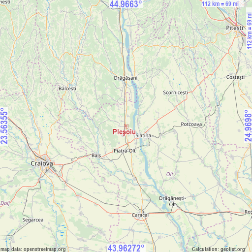
Pleşoiu GPS coordinates[2]
44° 28' 0.012" North, 24° 16' 0.012" East
| Map corner | latitude | longitude |
|---|---|---|
| Upper-left | 44.9663°, | 23.56355° |
| Center: | 44.46667°, | 24.26667° |
| Lower-right: | 43.96272°, | 24.9698° |
| Map W x H: | 111.6×111.6 km | = 69.3×69.3mi |
| max Lat: | 48.23793° ⇑86.2% North |
| Pleşoiu: | 44.46667° |
| min Lat: | ⇓13.8% South 43.65638° |
| min Long | Pleşoiu | max Long |
| 20.31667° | 24.26667° | 29.65403° |
| W 35.4%⇐ | ⇒64.6% E |
Elevation
Elevation of Pleşoiu is 127 m = 417 ft, and this is 127.9 m = 420 ft below average elevation for this country.
| Max E: |
1278 m = 4193 ft | 70% |
| Avg. | 254.9 m = 836 ft | |
| Pleşoiu | 127 m = 417 ft | |
Min E: |
-2 m = -7 ft | 30% |
See also: Romania elevation on elevation.city.
Geographical zone
Pleşoiu is located in North temperate zone (between Tropic of Cancer and the Arctic Circle). Distance of this Northern Tropic circle is 2338.3 km =1453 mi to South.| Distance of | km | miles | from Pleşoiu |
|---|---|---|---|
| North Pole | 5062.8 | 3145.9 | to North |
| Arctic Circle | 2456.9 | 1526.6 | to North |
| Tropic Cancer | 2338.3 | 1453 | to South |
| Equator | 4944.2 | 3072.2 | to South |


Nearby cities:
15 places around Pleşoiu: (largest is in red/bold)
• Arcești
2.6 km =1.6 mi,  269°
269°
• Arcești Cot
1 km =0.6 mi,  167°
167°
• Bistrița Nouă
8.1 km =5 mi,  201°
201°
• Cocorăști
4.7 km =2.9 mi,  295°
295°
• Colibași
4.4 km =2.7 mi,  8°
8°
• Curtişoara
6.5 km =4 mi,  54°
54°
• Doba
2.9 km =1.8 mi,  321°
321°
• Dobrotinet
6.6 km =4.1 mi,  77°
77°
• Dranovățu
3.5 km =2.2 mi,  163°
163°
• Găneasa
5.7 km =3.5 mi, 166°
• Izvoru
4.5 km =2.8 mi, 196°
• Linia din Vale
5.9 km =3.7 mi,  87°
87°
• Pietrișu
6.7 km =4.2 mi,  72°
72°
• Proaspeți
5.7 km =3.5 mi,  97°
97°
• Strejeşti
7.4 km =4.6 mi,  0°
0°
Sources, notices
• [Note1] Compared only with cities in Romania existing in our database
• [Src1] Map data: © OpenStreetMap contributors (CC-BY-SA)
• [Src2] Other city data from geonames.org with taken over terms of usage.
• [Src3] Geographical zone / Annual Mean Temperature by Robert A. Rohde @ Wikipedia
