Curtişoara geodata
Curtişoara (Olt) is a seat of a second-order administrative division; located in Romania in Europe/Bucharest (GMT+3) time zone. With population of 4,583 people, there are 926 cities with bigger population in this country. Compared to other cities in Romania, 85.2% of cities are located further ↑North; 63.2% of cities are located further →East and 71.4% of cities have higher elevation than Curtişoara. Note1


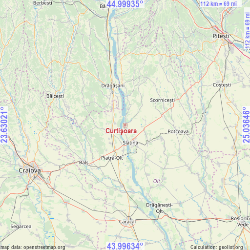
Curtişoara GPS coordinates[2]
44° 30' 0" North, 24° 19' 59.988" East
| Map corner | latitude | longitude |
|---|---|---|
| Upper-left | 44.99935°, | 23.63021° |
| Center: | 44.5°, | 24.33333° |
| Lower-right: | 43.99634°, | 25.03646° |
| Map W x H: | 111.5×111.5 km | = 69.3×69.3mi |
| max Lat: | 48.23793° ⇑85.2% North |
| Curtişoara: | 44.5° |
| min Lat: | ⇓14.8% South 43.65638° |
| min Long | Curtişoara | max Long |
| 20.31667° | 24.33333° | 29.65403° |
| W 36.8%⇐ | ⇒63.2% E |
Elevation
Elevation of Curtişoara is 122 m = 400 ft, and this is 132.9 m = 436 ft below average elevation for this country.
| Max E: |
1278 m = 4193 ft | 71.4% |
| Avg. | 254.9 m = 836 ft | |
| Curtişoara | 122 m = 400 ft | |
Min E: |
-2 m = -7 ft | 28.6% |
See also: Romania elevation on elevation.city.
Geographical zone
Curtişoara is located in North temperate zone (between Tropic of Cancer and the Arctic Circle). Distance of this Northern Tropic circle is 2342 km =1455.3 mi to South.| Distance of | km | miles | from Curtişoara |
|---|---|---|---|
| North Pole | 5059.1 | 3143.6 | to North |
| Arctic Circle | 2453.2 | 1524.3 | to North |
| Tropic Cancer | 2342 | 1455.3 | to South |
| Equator | 4947.9 | 3074.5 | to South |


Nearby cities:
15 places around Curtişoara: (largest is in red/bold)
• Arcești Cot
6.9 km =4.3 mi,  227°
227°
• Cireașov
6 km =3.7 mi,  147°
147°
• Colibași
4.7 km =2.9 mi,  278°
278°
• Deleni
7.7 km =4.8 mi,  16°
16°
• Doba
7.2 km =4.5 mi,  258°
258°
• Dobrotinet
2.5 km =1.6 mi, 153°
• Dranovățu
8.3 km =5.2 mi,  211°
211°
• Linia din Vale
3.5 km =2.2 mi,  170°
170°
• Pietrișu
2 km =1.2 mi, 146°
• Pleşoiu
6.5 km =4 mi, 234°
• Proaspeți
4.5 km =2.8 mi,  175°
175°
• Runcu Mare
8 km =5 mi,  321°
321°
• Slatina
7.9 km =4.9 mi,  160°
160°
• Strejeşti
6.5 km =4 mi,  305°
305°
• Teslui
3.2 km =2 mi,  54°
54°
Sources, notices
• [Note1] Compared only with cities in Romania existing in our database
• [Src1] Map data: © OpenStreetMap contributors (CC-BY-SA)
• [Src2] Other city data from geonames.org with taken over terms of usage.
• [Src3] Geographical zone / Annual Mean Temperature by Robert A. Rohde @ Wikipedia
