Oșorhei geodata
Oșorhei (Bihor) is a seat of a second-order administrative division; located in Romania in Europe/Bucharest (GMT+3) time zone. With population of 3,179 people, there are 1632 cities with bigger population in this country. Compared to other cities in Romania, 79.7% of cities are located further ↓South; 94.1% of cities are located further →East and 62.5% of cities have higher elevation than Oșorhei. Note1


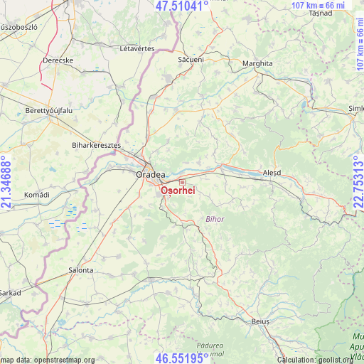
Oșorhei GPS coordinates[2]
47° 1' 59.988" North, 22° 3' 0" East
| Map corner | latitude | longitude |
|---|---|---|
| Upper-left | 47.51041°, | 21.34688° |
| Center: | 47.03333°, | 22.05° |
| Lower-right: | 46.55195°, | 22.75313° |
| Map W x H: | 106.6×106.6 km | = 66.2×66.2mi |
| max Lat: | 48.23793° ⇑20.3% North |
| Oșorhei: | 47.03333° |
| min Lat: | ⇓79.7% South 43.65638° |
| min Long | Oșorhei | max Long |
| 20.31667° | 22.05° | 29.65403° |
| W 5.9%⇐ | ⇒94.1% E |
Elevation
Elevation of Oșorhei is 157 m = 515 ft, and this is 97.9 m = 321 ft below average elevation for this country.
| Max E: |
1278 m = 4193 ft | 62.5% |
| Avg. | 254.9 m = 836 ft | |
| Oșorhei | 157 m = 515 ft | |
Min E: |
-2 m = -7 ft | 37.5% |
See also: Romania elevation on elevation.city.
Geographical zone
Oșorhei is located in North temperate zone (between Tropic of Cancer and the Arctic Circle). Distance of this North polar circle is 2171.6 km =1349.4 mi to North.| Distance of | km | miles | from Oșorhei |
|---|---|---|---|
| North Pole | 4777.4 | 2968.5 | to North |
| Arctic Circle | 2171.6 | 1349.4 | to North |
| Tropic Cancer | 2623.7 | 1630.3 | to South |
| Equator | 5229.6 | 3249.5 | to South |


Nearby cities:
15 places around Oșorhei: (largest is in red/bold)
• Alparea
0.3 km =0.2 mi,  204°
204°
• Cheriu
3.1 km =1.9 mi,  222°
222°
• Cihei
8.3 km =5.2 mi,  242°
242°
• Fughiu
2.6 km =1.6 mi,  353°
353°
• Haieu
5.8 km =3.6 mi, 222°
• Hidişelu de Sus
9.3 km =5.8 mi,  180°
180°
• Husasău de Criș
5.9 km =3.7 mi,  10°
10°
• Ineu
7.5 km =4.7 mi,  42°
42°
• Oradea
10.1 km =6.3 mi,  277°
277°
• Sînmartin
6.4 km =4 mi, 243°
• Săbolciu
9 km =5.6 mi,  59°
59°
• Săcădat
7.6 km =4.7 mi,  90°
90°
• Săldăbagiu de Munte
8.4 km =5.2 mi,  318°
318°
• Sărand
6.6 km =4.1 mi,  125°
125°
• Uileacu de Munte
10.2 km =6.3 mi,  337°
337°
Sources, notices
• [Note1] Compared only with cities in Romania existing in our database
• [Src1] Map data: © OpenStreetMap contributors (CC-BY-SA)
• [Src2] Other city data from geonames.org with taken over terms of usage.
• [Src3] Geographical zone / Annual Mean Temperature by Robert A. Rohde @ Wikipedia
