Negrești geodata
Negrești (Neamţ) is a seat of a second-order administrative division; located in Romania in Europe/Bucharest (GMT+3) time zone. With population of 1,624 people, there are 3012 cities with bigger population in this country. Compared to other cities in Romania, 79.6% of cities are located further ↓South; 70.4% of cities are located further ←West and 83.7% of cities have lower elevation than Negrești. Note1


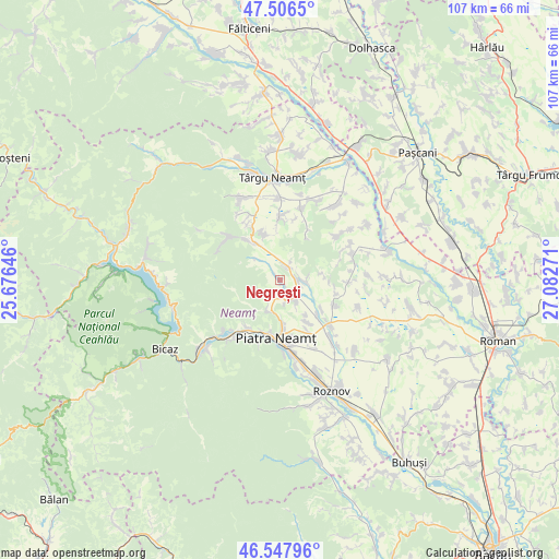
Negrești GPS coordinates[2]
47° 1' 45.768" North, 26° 22' 46.488" East
| Map corner | latitude | longitude |
|---|---|---|
| Upper-left | 47.5065°, | 25.67646° |
| Center: | 47.02938°, | 26.37958° |
| Lower-right: | 46.54796°, | 27.08271° |
| Map W x H: | 106.6×106.6 km | = 66.2×66.2mi |
| max Lat: | 48.23793° ⇑20.4% North |
| Negrești: | 47.02938° |
| min Lat: | ⇓79.6% South 43.65638° |
| min Long | Negrești | max Long |
| 20.31667° | 26.37958° | 29.65403° |
| W 70.4%⇐ | ⇒29.6% E |
Elevation
Elevation of Negrești is 431 m = 1414 ft, and this is 176.1 m = 578 ft above average elevation for this country.
| Max E: |
1278 m = 4193 ft | 16.3% |
| Negrești | 431 m 1414 ft | |
| Avg. | 254.9 m = 836 ft | |
Min E: |
-2 m = -7 ft | 83.7% |
See also: Romania elevation on elevation.city.
Geographical zone
Negrești is located in North temperate zone (between Tropic of Cancer and the Arctic Circle). Distance of this North polar circle is 2172 km =1349.6 mi to North.| Distance of | km | miles | from Negrești |
|---|---|---|---|
| North Pole | 4777.9 | 2968.8 | to North |
| Arctic Circle | 2172 | 1349.6 | to North |
| Tropic Cancer | 2623.3 | 1630 | to South |
| Equator | 5229.2 | 3249.3 | to South |


Nearby cities:
15 places around Negrești: (largest is in red/bold)
• Almaș
3.5 km =2.2 mi,  230°
230°
• Bistrița
11 km =6.8 mi,  215°
215°
• Bodeşti
2.8 km =1.7 mi,  81°
81°
• Bodeștii de Jos
4.9 km =3 mi,  92°
92°
• Crăcăoani
9.3 km =5.8 mi,  325°
325°
• Cuejdiu
7.8 km =4.8 mi,  236°
236°
• Căciulești
10.3 km =6.4 mi,  134°
134°
• Dobreni
5.8 km =3.6 mi,  151°
151°
• Ghindăoani
9.5 km =5.9 mi,  341°
341°
• Gura Văii
9.7 km =6 mi, 146°
• Gârcina
6.4 km =4 mi,  203°
203°
• Oșlobeni
3.1 km =1.9 mi,  33°
33°
• Poiana Crăcăoani
6.3 km =3.9 mi,  311°
311°
• Ştefan cel Mare
11.1 km =6.9 mi,  116°
116°
• Țolici
11.2 km =7 mi, 27°
Sources, notices
• [Note1] Compared only with cities in Romania existing in our database
• [Src1] Map data: © OpenStreetMap contributors (CC-BY-SA)
• [Src2] Other city data from geonames.org with taken over terms of usage.
• [Src3] Geographical zone / Annual Mean Temperature by Robert A. Rohde @ Wikipedia
