Almaș geodata
Almaș (Neamţ) is a populated place; located in Romania in Europe/Bucharest (GMT+3) time zone. With population of 560 people, there are 6501 cities with bigger population in this country. Compared to other cities in Romania, 79.2% of cities are located further ↓South; 69.7% of cities are located further ←West and 89% of cities have lower elevation than Almaș. Note1


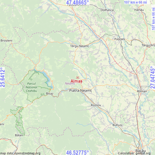
Almaș GPS coordinates[2]
47° 0' 33.66" North, 26° 20' 39.552" East
| Map corner | latitude | longitude |
|---|---|---|
| Upper-left | 47.48665°, | 25.6412° |
| Center: | 47.00935°, | 26.34432° |
| Lower-right: | 46.52775°, | 27.04745° |
| Map W x H: | 106.6×106.6 km | = 66.2×66.2mi |
| max Lat: | 48.23793° ⇑20.8% North |
| Almaș: | 47.00935° |
| min Lat: | ⇓79.2% South 43.65638° |
| min Long | Almaș | max Long |
| 20.31667° | 26.34432° | 29.65403° |
| W 69.7%⇐ | ⇒30.3% E |
Elevation
Elevation of Almaș is 497 m = 1631 ft, and this is 242.1 m = 794 ft above average elevation for this country.
| Max E: |
1278 m = 4193 ft | 11% |
| Almaș | 497 m 1631 ft | |
| Avg. | 254.9 m = 836 ft | |
Min E: |
-2 m = -7 ft | 89% |
See also: Romania elevation on elevation.city.
Geographical zone
Almaș is located in North temperate zone (between Tropic of Cancer and the Arctic Circle). Distance of this North polar circle is 2174.2 km =1351 mi to North.| Distance of | km | miles | from Almaș |
|---|---|---|---|
| North Pole | 4780.1 | 2970.2 | to North |
| Arctic Circle | 2174.2 | 1351 | to North |
| Tropic Cancer | 2621 | 1628.6 | to South |
| Equator | 5226.9 | 3247.8 | to South |


Nearby cities:
15 places around Almaș: (largest is in red/bold)
• Bistrița
7.7 km =4.8 mi,  208°
208°
• Bodeşti
6.1 km =3.8 mi,  64°
64°
• Bodeștii de Jos
7.9 km =4.9 mi,  75°
75°
• Ciritei
10 km =6.2 mi,  150°
150°
• Crăcăoani
10.2 km =6.3 mi,  345°
345°
• Cuejdiu
4.3 km =2.7 mi,  240°
240°
• Dobreni
6.2 km =3.9 mi,  117°
117°
• Gura Văii
9.9 km =6.2 mi,  126°
126°
• Gârcina
3.6 km =2.2 mi,  178°
178°
• Negrești
3.5 km =2.2 mi,  50°
50°
• Oșlobeni
6.5 km =4 mi,  42°
42°
• Piatra Neamţ
10.3 km =6.4 mi, 184°
• Poiana Crăcăoani
6.7 km =4.2 mi,  341°
341°
• Vaduri
11.1 km =6.9 mi, 214°
• Vădurele
11.1 km =6.9 mi,  219°
219°
Sources, notices
• [Note1] Compared only with cities in Romania existing in our database
• [Src1] Map data: © OpenStreetMap contributors (CC-BY-SA)
• [Src2] Other city data from geonames.org with taken over terms of usage.
• [Src3] Geographical zone / Annual Mean Temperature by Robert A. Rohde @ Wikipedia
