Gârcina geodata
Gârcina (Neamţ) is a seat of a second-order administrative division; located in Romania in Europe/Bucharest (GMT+3) time zone. With population of 2,402 people, there are 2235 cities with bigger population in this country. Compared to other cities in Romania, 78.4% of cities are located further ↓South; 69.8% of cities are located further ←West and 82.1% of cities have lower elevation than Gârcina. Note1


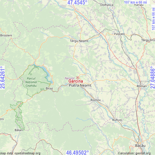
Gârcina GPS coordinates[2]
46° 58' 36.876" North, 26° 20' 44.628" East
| Map corner | latitude | longitude |
|---|---|---|
| Upper-left | 47.4545°, | 25.64261° |
| Center: | 46.97691°, | 26.34573° |
| Lower-right: | 46.49502°, | 27.04886° |
| Map W x H: | 106.7×106.7 km | = 66.3×66.3mi |
| max Lat: | 48.23793° ⇑21.6% North |
| Gârcina: | 46.97691° |
| min Lat: | ⇓78.4% South 43.65638° |
| min Long | Gârcina | max Long |
| 20.31667° | 26.34573° | 29.65403° |
| W 69.8%⇐ | ⇒30.2% E |
Elevation
Elevation of Gârcina is 413 m = 1355 ft, and this is 158.1 m = 519 ft above average elevation for this country.
| Max E: |
1278 m = 4193 ft | 17.9% |
| Gârcina | 413 m 1355 ft | |
| Avg. | 254.9 m = 836 ft | |
Min E: |
-2 m = -7 ft | 82.1% |
See also: Romania elevation on elevation.city.
Geographical zone
Gârcina is located in North temperate zone (between Tropic of Cancer and the Arctic Circle). Distance of this North polar circle is 2177.8 km =1353.2 mi to North.| Distance of | km | miles | from Gârcina |
|---|---|---|---|
| North Pole | 4783.7 | 2972.5 | to North |
| Arctic Circle | 2177.8 | 1353.2 | to North |
| Tropic Cancer | 2617.4 | 1626.4 | to South |
| Equator | 5223.3 | 3245.6 | to South |


Nearby cities:
15 places around Gârcina: (largest is in red/bold)
• Almaș
3.6 km =2.2 mi,  358°
358°
• Bistrița
4.9 km =3 mi,  230°
230°
• Bodeşti
8.3 km =5.2 mi,  40°
40°
• Bodeștii de Jos
9.4 km =5.8 mi,  53°
53°
• Ciritei
7 km =4.3 mi,  136°
136°
• Cuejdiu
4.2 km =2.6 mi,  291°
291°
• Dobreni
5.4 km =3.4 mi,  82°
82°
• Gura Văii
8.2 km =5.1 mi,  105°
105°
• Negrești
6.4 km =4 mi,  23°
23°
• Oșlobeni
9.4 km =5.8 mi,  27°
27°
• Piatra Neamţ
6.8 km =4.2 mi,  187°
187°
• Vaduri
8.5 km =5.3 mi, 229°
• Viişoara
9.8 km =6.1 mi,  240°
240°
• Vădurele
8.7 km =5.4 mi, 236°
• Văleni
8.9 km =5.5 mi,  158°
158°
Sources, notices
• [Note1] Compared only with cities in Romania existing in our database
• [Src1] Map data: © OpenStreetMap contributors (CC-BY-SA)
• [Src2] Other city data from geonames.org with taken over terms of usage.
• [Src3] Geographical zone / Annual Mean Temperature by Robert A. Rohde @ Wikipedia
