Negreni geodata
Negreni (Cluj) is a seat of a second-order administrative division; located in Romania in Europe/Bucharest (GMT+3) time zone. With population of 1,855 people, there are 2755 cities with bigger population in this country. Compared to other cities in Romania, 78% of cities are located further ↓South; 87.6% of cities are located further →East and 83.4% of cities have lower elevation than Negreni. Note1


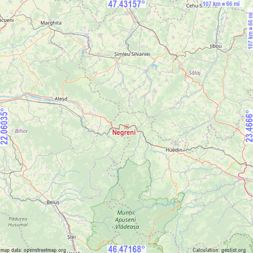
Negreni GPS coordinates[2]
46° 57' 13.608" North, 22° 45' 48.492" East
| Map corner | latitude | longitude |
|---|---|---|
| Upper-left | 47.43157°, | 22.06035° |
| Center: | 46.95378°, | 22.76347° |
| Lower-right: | 46.47168°, | 23.4666° |
| Map W x H: | 106.7×106.7 km | = 66.3×66.3mi |
| max Lat: | 48.23793° ⇑22% North |
| Negreni: | 46.95378° |
| min Lat: | ⇓78% South 43.65638° |
| min Long | Negreni | max Long |
| 20.31667° | 22.76347° | 29.65403° |
| W 12.4%⇐ | ⇒87.6% E |
Elevation
Elevation of Negreni is 428 m = 1404 ft, and this is 173.1 m = 568 ft above average elevation for this country.
| Max E: |
1278 m = 4193 ft | 16.6% |
| Negreni | 428 m 1404 ft | |
| Avg. | 254.9 m = 836 ft | |
Min E: |
-2 m = -7 ft | 83.4% |
See also: Romania elevation on elevation.city.
Geographical zone
Negreni is located in North temperate zone (between Tropic of Cancer and the Arctic Circle). Distance of this North polar circle is 2180.4 km =1354.8 mi to North.| Distance of | km | miles | from Negreni |
|---|---|---|---|
| North Pole | 4786.3 | 2974.1 | to North |
| Arctic Circle | 2180.4 | 1354.8 | to North |
| Tropic Cancer | 2614.9 | 1624.8 | to South |
| Equator | 5220.8 | 3244.1 | to South |


Nearby cities:
15 places around Negreni: (largest is in red/bold)
• Beznea
10.9 km =6.8 mi,  273°
273°
• Borod
10.4 km =6.5 mi,  288°
288°
• Bratca
11.4 km =7.1 mi,  258°
258°
• Bucea
5.3 km =3.3 mi, 263°
• Bulz
7.4 km =4.6 mi,  235°
235°
• Ciucea
4.1 km =2.5 mi,  95°
95°
• Cornițel
9.7 km =6 mi, 290°
• Lorău
10.8 km =6.7 mi,  247°
247°
• Munteni
9.9 km =6.2 mi,  211°
211°
• Poieni
8.2 km =5.1 mi,  118°
118°
• Ponoară
11 km =6.8 mi,  226°
226°
• Tusa
10.2 km =6.3 mi,  5°
5°
• Valea Crișului
9.1 km =5.7 mi, 268°
• Vânători
7.6 km =4.7 mi,  89°
89°
• Șerani
11.3 km =7 mi,  326°
326°
Sources, notices
• [Note1] Compared only with cities in Romania existing in our database
• [Src1] Map data: © OpenStreetMap contributors (CC-BY-SA)
• [Src2] Other city data from geonames.org with taken over terms of usage.
• [Src3] Geographical zone / Annual Mean Temperature by Robert A. Rohde @ Wikipedia
