Mânăstirea geodata
Mânăstirea (Dâmboviţa) is a populated place; located in Romania in Europe/Bucharest (GMT+3) time zone. With population of 633 people, there are 5989 cities with bigger population in this country. Compared to other cities in Romania, 83.3% of cities are located further ↑North; 61.5% of cities are located further ←West and 75.9% of cities have higher elevation than Mânăstirea. Note1


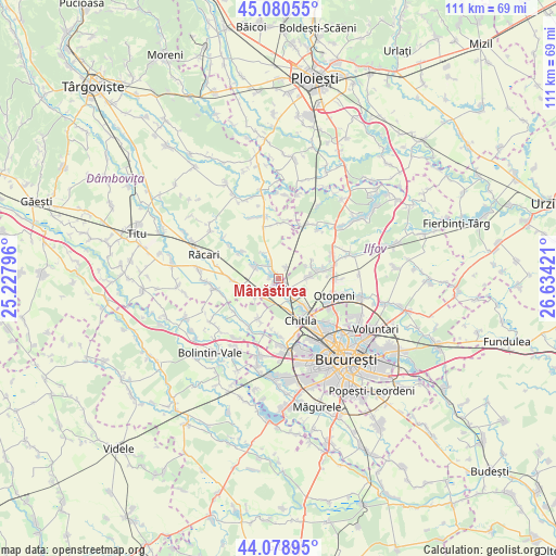
Mânăstirea GPS coordinates[2]
44° 34' 54.876" North, 25° 55' 51.888" East
| Map corner | latitude | longitude |
|---|---|---|
| Upper-left | 45.08055°, | 25.22796° |
| Center: | 44.58191°, | 25.93108° |
| Lower-right: | 44.07895°, | 26.63421° |
| Map W x H: | 111.4×111.4 km | = 69.2×69.2mi |
| max Lat: | 48.23793° ⇑83.3% North |
| Mânăstirea: | 44.58191° |
| min Lat: | ⇓16.7% South 43.65638° |
| min Long | Mânăstirea | max Long |
| 20.31667° | 25.93108° | 29.65403° |
| W 61.5%⇐ | ⇒38.5% E |
Elevation
Elevation of Mânăstirea is 107 m = 351 ft, and this is 147.9 m = 485 ft below average elevation for this country.
| Max E: |
1278 m = 4193 ft | 75.9% |
| Avg. | 254.9 m = 836 ft | |
| Mânăstirea | 107 m = 351 ft | |
Min E: |
-2 m = -7 ft | 24.1% |
See also: Romania elevation on elevation.city.
Geographical zone
Mânăstirea is located in North temperate zone (between Tropic of Cancer and the Arctic Circle). Distance of this Northern Tropic circle is 2351.1 km =1460.9 mi to South.| Distance of | km | miles | from Mânăstirea |
|---|---|---|---|
| North Pole | 5050 | 3137.9 | to North |
| Arctic Circle | 2444.1 | 1518.7 | to North |
| Tropic Cancer | 2351.1 | 1460.9 | to South |
| Equator | 4957 | 3080.1 | to South |


Nearby cities:
15 places around Mânăstirea: (largest is in red/bold)
• Buciumeni
4.4 km =2.7 mi,  143°
143°
• Buftea
2.7 km =1.7 mi,  148°
148°
• Chitila
9.2 km =5.7 mi, 153°
• Ciocăneşti
6.7 km =4.2 mi,  287°
287°
• Cocani
5.9 km =3.7 mi,  331°
331°
• Crevedia
2 km =1.2 mi,  5°
5°
• Crețu
9.3 km =5.8 mi,  300°
300°
• Decindea
5.5 km =3.4 mi, 291°
• Dârza
2.6 km =1.6 mi,  33°
33°
• Gulia
6 km =3.7 mi,  229°
229°
• Mogoşoaia
8 km =5 mi, 137°
• Samurcași
1.1 km =0.7 mi, 229°
• Tamași
6 km =3.7 mi,  87°
87°
• Tărtăşeşti
9.4 km =5.8 mi,  266°
266°
• Urziceanca
8.9 km =5.5 mi,  307°
307°
Sources, notices
• [Note1] Compared only with cities in Romania existing in our database
• [Src1] Map data: © OpenStreetMap contributors (CC-BY-SA)
• [Src2] Other city data from geonames.org with taken over terms of usage.
• [Src3] Geographical zone / Annual Mean Temperature by Robert A. Rohde @ Wikipedia
