Mănăilești geodata
Mănăilești (Vâlcea) is a populated place; located in Romania in Europe/Bucharest (GMT+3) time zone. With population of 1,015 people, there are 4246 cities with bigger population in this country. Compared to other cities in Romania, 68.8% of cities are located further ↑North; 67.3% of cities are located further →East and 63.6% of cities have lower elevation than Mănăilești. Note1


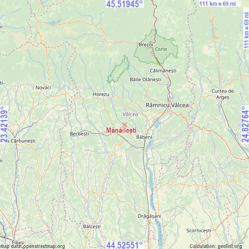
Mănăilești GPS coordinates[2]
45° 1' 28.704" North, 24° 7' 28.236" East
| Map corner | latitude | longitude |
|---|---|---|
| Upper-left | 45.51945°, | 23.42139° |
| Center: | 45.02464°, | 24.12451° |
| Lower-right: | 44.52551°, | 24.82764° |
| Map W x H: | 110.5×110.5 km | = 68.7×68.7mi |
| max Lat: | 48.23793° ⇑68.8% North |
| Mănăilești: | 45.02464° |
| min Lat: | ⇓31.2% South 43.65638° |
| min Long | Mănăilești | max Long |
| 20.31667° | 24.12451° | 29.65403° |
| W 32.7%⇐ | ⇒67.3% E |
Elevation
Elevation of Mănăilești is 282 m = 925 ft, and this is 27.1 m = 89 ft above average elevation for this country.
| Max E: |
1278 m = 4193 ft | 36.4% |
| Mănăilești | 282 m 925 ft | |
| Avg. | 254.9 m = 836 ft | |
Min E: |
-2 m = -7 ft | 63.6% |
See also: Romania elevation on elevation.city.
Geographical zone
Mănăilești is located in North temperate zone (between Tropic of Cancer and the Arctic Circle). Distance of this North polar circle is 2394.9 km =1488.1 mi to North.| Distance of | km | miles | from Mănăilești |
|---|---|---|---|
| North Pole | 5000.8 | 3107.4 | to North |
| Arctic Circle | 2394.9 | 1488.1 | to North |
| Tropic Cancer | 2400.4 | 1491.5 | to South |
| Equator | 5006.3 | 3110.8 | to South |


Nearby cities:
15 places around Mănăilești: (largest is in red/bold)
• Băile Govora
8 km =5 mi,  35°
35°
• Băltățeni
8.1 km =5 mi,  326°
326°
• Ciorăști
8 km =5 mi,  159°
159°
• Coșani
5.6 km =3.5 mi,  109°
109°
• Dezrobiți
4.9 km =3 mi,  86°
86°
• Dăeşti
6.5 km =4 mi,  173°
173°
• Foleştii de Jos
5.4 km =3.4 mi,  319°
319°
• Frânceşti
5.9 km =3.7 mi,  118°
118°
• Genuneni
1.3 km =0.8 mi,  306°
306°
• Modoia
7.5 km =4.7 mi,  224°
224°
• Pietrari
8.4 km =5.2 mi,  4°
4°
• Popeşti
5 km =3.1 mi,  202°
202°
• Prajila
7.4 km =4.6 mi,  28°
28°
• Păuşeşti
5.5 km =3.4 mi,  8°
8°
• Urși
4.4 km =2.7 mi, 219°
Sources, notices
• [Note1] Compared only with cities in Romania existing in our database
• [Src1] Map data: © OpenStreetMap contributors (CC-BY-SA)
• [Src2] Other city data from geonames.org with taken over terms of usage.
• [Src3] Geographical zone / Annual Mean Temperature by Robert A. Rohde @ Wikipedia
