Măgura geodata
Măgura (Teleorman) is a seat of a second-order administrative division; located in Romania in Europe/Bucharest (GMT+3) time zone. With population of 3,070 people, there are 1716 cities with bigger population in this country. Compared to other cities in Romania, 96.5% of cities are located further ↑North; 52.8% of cities are located further ←West and 88.5% of cities have higher elevation than Măgura. Note1


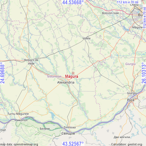
Măgura GPS coordinates[2]
44° 1' 59.988" North, 25° 24' 0" East
| Map corner | latitude | longitude |
|---|---|---|
| Upper-left | 44.53668°, | 24.69688° |
| Center: | 44.03333°, | 25.4° |
| Lower-right: | 43.52567°, | 26.10313° |
| Map W x H: | 112.4×112.4 km | = 69.8×69.8mi |
| max Lat: | 48.23793° ⇑96.5% North |
| Măgura: | 44.03333° |
| min Lat: | ⇓3.5% South 43.65638° |
| min Long | Măgura | max Long |
| 20.31667° | 25.4° | 29.65403° |
| W 52.8%⇐ | ⇒47.2% E |
Elevation
Elevation of Măgura is 65 m = 213 ft, and this is 189.9 m = 623 ft below average elevation for this country.
| Max E: |
1278 m = 4193 ft | 88.5% |
| Avg. | 254.9 m = 836 ft | |
| Măgura | 65 m = 213 ft | |
Min E: |
-2 m = -7 ft | 11.5% |
See also: Romania elevation on elevation.city.
Geographical zone
Măgura is located in North temperate zone (between Tropic of Cancer and the Arctic Circle). Distance of this Northern Tropic circle is 2290.1 km =1423 mi to South.| Distance of | km | miles | from Măgura |
|---|---|---|---|
| North Pole | 5111 | 3175.8 | to North |
| Arctic Circle | 2505.1 | 1556.6 | to North |
| Tropic Cancer | 2290.1 | 1423 | to South |
| Equator | 4896 | 3042.2 | to South |


Nearby cities:
15 places around Măgura: (largest is in red/bold)
• Alexandria
7.7 km =4.8 mi,  223°
223°
• Comoara
12.3 km =7.6 mi,  44°
44°
• Guruieni
2.8 km =1.7 mi,  354°
354°
• Lăceni
7.8 km =4.8 mi,  316°
316°
• Mavrodin
12 km =7.5 mi,  270°
270°
• Merișani
9.3 km =5.8 mi,  359°
359°
• Mârzăneşti
12.3 km =7.6 mi,  154°
154°
• Nanov
8.8 km =5.5 mi,  245°
245°
• Orbeasca de Jos
11.3 km =7 mi,  330°
330°
• Poroschia
11.4 km =7.1 mi,  193°
193°
• Purani
6.6 km =4.1 mi, 153°
• Schitu Poienari
7.9 km =4.9 mi,  128°
128°
• Siliștea
6.5 km =4 mi,  124°
124°
• Teleormanu
9.2 km =5.7 mi, 149°
• Vităneşti
3.9 km =2.4 mi,  160°
160°
Sources, notices
• [Note1] Compared only with cities in Romania existing in our database
• [Src1] Map data: © OpenStreetMap contributors (CC-BY-SA)
• [Src2] Other city data from geonames.org with taken over terms of usage.
• [Src3] Geographical zone / Annual Mean Temperature by Robert A. Rohde @ Wikipedia
