Lăceni geodata
Lăceni (Teleorman) is a populated place; located in Romania in Europe/Bucharest (GMT+3) time zone. With population of 2,569 people, there are 2104 cities with bigger population in this country. Compared to other cities in Romania, 95.7% of cities are located further ↑North; 51.7% of cities are located further ←West and 89.5% of cities have higher elevation than Lăceni. Note1


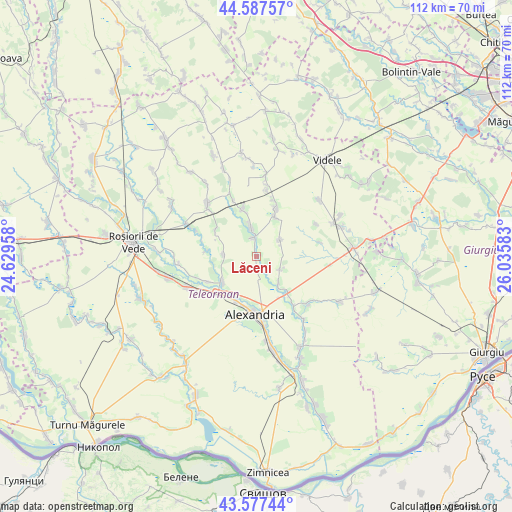
Lăceni GPS coordinates[2]
44° 5' 4.776" North, 25° 19' 57.72" East
| Map corner | latitude | longitude |
|---|---|---|
| Upper-left | 44.58757°, | 24.62958° |
| Center: | 44.08466°, | 25.3327° |
| Lower-right: | 43.57744°, | 26.03583° |
| Map W x H: | 112.3×112.3 km | = 69.8×69.8mi |
| max Lat: | 48.23793° ⇑95.7% North |
| Lăceni: | 44.08466° |
| min Lat: | ⇓4.3% South 43.65638° |
| min Long | Lăceni | max Long |
| 20.31667° | 25.3327° | 29.65403° |
| W 51.7%⇐ | ⇒48.3% E |
Elevation
Elevation of Lăceni is 60 m = 197 ft, and this is 194.9 m = 639 ft below average elevation for this country.
| Max E: |
1278 m = 4193 ft | 89.5% |
| Avg. | 254.9 m = 836 ft | |
| Lăceni | 60 m = 197 ft | |
Min E: |
-2 m = -7 ft | 10.5% |
See also: Romania elevation on elevation.city.
Geographical zone
Lăceni is located in North temperate zone (between Tropic of Cancer and the Arctic Circle). Distance of this Northern Tropic circle is 2295.8 km =1426.5 mi to South.| Distance of | km | miles | from Lăceni |
|---|---|---|---|
| North Pole | 5105.3 | 3172.3 | to North |
| Arctic Circle | 2499.4 | 1553.1 | to North |
| Tropic Cancer | 2295.8 | 1426.5 | to South |
| Equator | 4901.8 | 3045.8 | to South |


Nearby cities:
15 places around Lăceni: (largest is in red/bold)
• Alexandria
11.3 km =7 mi,  179°
179°
• Buzescu
11 km =6.8 mi,  226°
226°
• Băbăiţa
10 km =6.2 mi,  23°
23°
• Copăceanca
10.7 km =6.6 mi,  300°
300°
• Călineşti
7.9 km =4.9 mi,  268°
268°
• Frăsinet
11.4 km =7.1 mi, 20°
• Guruieni
5.9 km =3.7 mi,  119°
119°
• Licuriciu
11 km =6.8 mi,  277°
277°
• Mavrodin
8.7 km =5.4 mi, 229°
• Merișani
6.4 km =4 mi,  56°
56°
• Măgura
7.8 km =4.8 mi,  136°
136°
• Nanov
9.8 km =6.1 mi,  195°
195°
• Orbeasca de Jos
4.1 km =2.5 mi,  356°
356°
• Orbeasca de Sus
7.4 km =4.6 mi,  350°
350°
• Vităneşti
11.6 km =7.2 mi, 144°
Sources, notices
• [Note1] Compared only with cities in Romania existing in our database
• [Src1] Map data: © OpenStreetMap contributors (CC-BY-SA)
• [Src2] Other city data from geonames.org with taken over terms of usage.
• [Src3] Geographical zone / Annual Mean Temperature by Robert A. Rohde @ Wikipedia
