Lunca Leșului geodata
Lunca Leșului (Bistriţa-Năsăud) is a populated place; located in Romania in Europe/Bucharest (GMT+3) time zone. With population of 1,339 people, there are 3447 cities with bigger population in this country. Compared to other cities in Romania, 86.8% of cities are located further ↓South; 55.9% of cities are located further →East and 91.7% of cities have lower elevation than Lunca Leșului. Note1


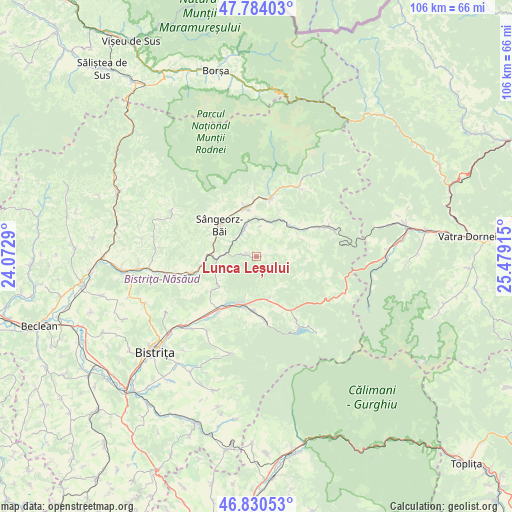
Lunca Leșului GPS coordinates[2]
47° 18' 33.948" North, 24° 46' 33.672" East
| Map corner | latitude | longitude |
|---|---|---|
| Upper-left | 47.78403°, | 24.0729° |
| Center: | 47.30943°, | 24.77602° |
| Lower-right: | 46.83053°, | 25.47915° |
| Map W x H: | 106×106 km | = 65.9×65.9mi |
| max Lat: | 48.23793° ⇑13.2% North |
| Lunca Leșului: | 47.30943° |
| min Lat: | ⇓86.8% South 43.65638° |
| min Long | Lunca Leșului | max Long |
| 20.31667° | 24.77602° | 29.65403° |
| W 44.1%⇐ | ⇒55.9% E |
Elevation
Elevation of Lunca Leșului is 544 m = 1785 ft, and this is 289.1 m = 948 ft above average elevation for this country.
| Max E: |
1278 m = 4193 ft | 8.3% |
| Lunca Leșului | 544 m 1785 ft | |
| Avg. | 254.9 m = 836 ft | |
Min E: |
-2 m = -7 ft | 91.7% |
See also: Romania elevation on elevation.city.
Geographical zone
Lunca Leșului is located in North temperate zone (between Tropic of Cancer and the Arctic Circle). Distance of this North polar circle is 2140.9 km =1330.3 mi to North.| Distance of | km | miles | from Lunca Leșului |
|---|---|---|---|
| North Pole | 4746.7 | 2949.5 | to North |
| Arctic Circle | 2140.9 | 1330.3 | to North |
| Tropic Cancer | 2654.4 | 1649.4 | to South |
| Equator | 5260.3 | 3268.6 | to South |


Nearby cities:
15 places around Lunca Leșului: (largest is in red/bold)
• Arșița
7.1 km =4.4 mi,  38°
38°
• Bistriţa Bârgăului
10.3 km =6.4 mi,  183°
183°
• Cormaia
9.4 km =5.8 mi,  312°
312°
• Ilva Mare
11.3 km =7 mi,  55°
55°
• Ilva Mică
8.3 km =5.2 mi,  275°
275°
• Ivăneasa
10.5 km =6.5 mi,  71°
71°
• Leşu
2.1 km =1.3 mi,  292°
292°
• Măgura Ilvei
8.4 km =5.2 mi,  12°
12°
• Măieru
10.3 km =6.4 mi,  348°
348°
• Poiana Ilvei
6 km =3.7 mi,  333°
333°
• Prundu Bârgăului
10.3 km =6.4 mi,  194°
194°
• Susenii Bârgăului
10.9 km =6.8 mi,  208°
208°
• Sângeorz-Băi
10.2 km =6.3 mi, 309°
• Tiha Bârgăului
8.5 km =5.3 mi, 184°
• Tureac
9.2 km =5.7 mi,  165°
165°
Sources, notices
• [Note1] Compared only with cities in Romania existing in our database
• [Src1] Map data: © OpenStreetMap contributors (CC-BY-SA)
• [Src2] Other city data from geonames.org with taken over terms of usage.
• [Src3] Geographical zone / Annual Mean Temperature by Robert A. Rohde @ Wikipedia
