Licuriciu geodata
Licuriciu (Teleorman) is a populated place; located in Romania in Europe/Bucharest (GMT+3) time zone. With population of 895 people, there are 4638 cities with bigger population in this country. Compared to other cities in Romania, 95.5% of cities are located further ↑North; 50% of cities are located further ←West and 83.8% of cities have higher elevation than Licuriciu. Note1


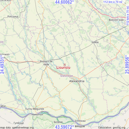
Licuriciu GPS coordinates[2]
44° 5' 52.188" North, 25° 11' 47.148" East
| Map corner | latitude | longitude |
|---|---|---|
| Upper-left | 44.60062°, | 24.49331° |
| Center: | 44.09783°, | 25.19643° |
| Lower-right: | 43.59072°, | 25.89956° |
| Map W x H: | 112.3×112.3 km | = 69.8×69.8mi |
| max Lat: | 48.23793° ⇑95.5% North |
| Licuriciu: | 44.09783° |
| min Lat: | ⇓4.5% South 43.65638° |
| min Long | Licuriciu | max Long |
| 20.31667° | 25.19643° | 29.65403° |
| W 50%⇐ | ⇒50% E |
Elevation
Elevation of Licuriciu is 82 m = 269 ft, and this is 172.9 m = 567 ft below average elevation for this country.
| Max E: |
1278 m = 4193 ft | 83.8% |
| Avg. | 254.9 m = 836 ft | |
| Licuriciu | 82 m = 269 ft | |
Min E: |
-2 m = -7 ft | 16.2% |
See also: Romania elevation on elevation.city.
Geographical zone
Licuriciu is located in North temperate zone (between Tropic of Cancer and the Arctic Circle). Distance of this Northern Tropic circle is 2297.3 km =1427.5 mi to South.| Distance of | km | miles | from Licuriciu |
|---|---|---|---|
| North Pole | 5103.8 | 3171.4 | to North |
| Arctic Circle | 2498 | 1552.2 | to North |
| Tropic Cancer | 2297.3 | 1427.5 | to South |
| Equator | 4903.2 | 3046.7 | to South |


Nearby cities:
15 places around Licuriciu: (largest is in red/bold)
• Albești
6.9 km =4.3 mi,  241°
241°
• Buzescu
9.5 km =5.9 mi,  161°
161°
• Cetatea
4.8 km =3 mi,  329°
329°
• Copăceanca
4.3 km =2.7 mi,  22°
22°
• Călineşti
3.4 km =2.1 mi,  118°
118°
• Dulceanca
7.1 km =4.4 mi,  262°
262°
• Mavrodin
8.4 km =5.2 mi,  149°
149°
• Nenciulești
7 km =4.3 mi,  177°
177°
• Peretu
10.5 km =6.5 mi, 239°
• Plosca
8.8 km =5.5 mi,  215°
215°
• Păru Rotund
6.5 km =4 mi,  198°
198°
• Rădoiești-Deal
7.7 km =4.8 mi,  319°
319°
• Rădoiești-Vale
6.4 km =4 mi, 327°
• Vârtoapele de Jos
9.5 km =5.9 mi,  1°
1°
• Vârtoapele de Sus
10.5 km =6.5 mi, 1°
Sources, notices
• [Note1] Compared only with cities in Romania existing in our database
• [Src1] Map data: © OpenStreetMap contributors (CC-BY-SA)
• [Src2] Other city data from geonames.org with taken over terms of usage.
• [Src3] Geographical zone / Annual Mean Temperature by Robert A. Rohde @ Wikipedia
