Peretu geodata
Peretu (Teleorman) is a seat of a second-order administrative division; located in Romania in Europe/Bucharest (GMT+3) time zone. With population of 7,816 people, there are 327 cities with bigger population in this country. Compared to other cities in Romania, 96.2% of cities are located further ↑North; 51.6% of cities are located further →East and 87.4% of cities have higher elevation than Peretu. Note1


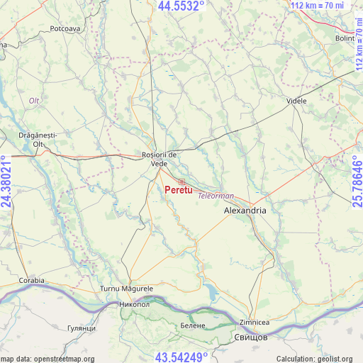
Peretu GPS coordinates[2]
44° 3' 0" North, 25° 4' 59.988" East
| Map corner | latitude | longitude |
|---|---|---|
| Upper-left | 44.5532°, | 24.38021° |
| Center: | 44.05°, | 25.08333° |
| Lower-right: | 43.54249°, | 25.78646° |
| Map W x H: | 112.4×112.4 km | = 69.8×69.8mi |
| max Lat: | 48.23793° ⇑96.2% North |
| Peretu: | 44.05° |
| min Lat: | ⇓3.8% South 43.65638° |
| min Long | Peretu | max Long |
| 20.31667° | 25.08333° | 29.65403° |
| W 48.4%⇐ | ⇒51.6% E |
Elevation
Elevation of Peretu is 70 m = 230 ft, and this is 184.9 m = 607 ft below average elevation for this country.
| Max E: |
1278 m = 4193 ft | 87.4% |
| Avg. | 254.9 m = 836 ft | |
| Peretu | 70 m = 230 ft | |
Min E: |
-2 m = -7 ft | 12.6% |
See also: Romania elevation on elevation.city.
Geographical zone
Peretu is located in North temperate zone (between Tropic of Cancer and the Arctic Circle). Distance of this Northern Tropic circle is 2292 km =1424.2 mi to South.| Distance of | km | miles | from Peretu |
|---|---|---|---|
| North Pole | 5109.2 | 3174.7 | to North |
| Arctic Circle | 2503.3 | 1555.5 | to North |
| Tropic Cancer | 2292 | 1424.2 | to South |
| Equator | 4897.9 | 3043.4 | to South |


Nearby cities:
15 places around Peretu: (largest is in red/bold)
• Albești
3.6 km =2.2 mi,  55°
55°
• Cetatea
11.6 km =7.2 mi,  35°
35°
• Coșoteni
9.2 km =5.7 mi,  329°
329°
• Drăgăneşti de Vede
9.6 km =6 mi,  343°
343°
• Dulceanca
4.9 km =3 mi,  23°
23°
• Licuriciu
10.5 km =6.5 mi, 59°
• Meri
6.1 km =3.8 mi, 337°
• Nenciulești
9.5 km =5.9 mi,  100°
100°
• Plosca
4.4 km =2.7 mi,  114°
114°
• Păru Rotund
7 km =4.3 mi, 96°
• Roșiorii de Vede
10.9 km =6.8 mi,  312°
312°
• Troianul
8.7 km =5.4 mi,  230°
230°
• Urluiu
10.8 km =6.7 mi,  192°
192°
• Vedea
3.9 km =2.4 mi, 340°
• Văcărești
10.6 km =6.6 mi, 332°
Sources, notices
• [Note1] Compared only with cities in Romania existing in our database
• [Src1] Map data: © OpenStreetMap contributors (CC-BY-SA)
• [Src2] Other city data from geonames.org with taken over terms of usage.
• [Src3] Geographical zone / Annual Mean Temperature by Robert A. Rohde @ Wikipedia
