Lehliu geodata
Lehliu (Călăraşi) is a seat of a second-order administrative division; located in Romania in Europe/Bucharest (GMT+3) time zone. With population of 2,953 people, there are 1816 cities with bigger population in this country. Compared to other cities in Romania, 86.2% of cities are located further ↑North; 79% of cities are located further ←West and 92.6% of cities have higher elevation than Lehliu. Note1


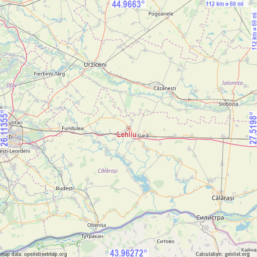
Lehliu GPS coordinates[2]
44° 28' 0.012" North, 26° 49' 0.012" East
| Map corner | latitude | longitude |
|---|---|---|
| Upper-left | 44.9663°, | 26.11355° |
| Center: | 44.46667°, | 26.81667° |
| Lower-right: | 43.96272°, | 27.5198° |
| Map W x H: | 111.6×111.6 km | = 69.3×69.3mi |
| max Lat: | 48.23793° ⇑86.2% North |
| Lehliu: | 44.46667° |
| min Lat: | ⇓13.8% South 43.65638° |
| min Long | Lehliu | max Long |
| 20.31667° | 26.81667° | 29.65403° |
| W 79%⇐ | ⇒21% E |
Elevation
Elevation of Lehliu is 46 m = 151 ft, and this is 208.9 m = 685 ft below average elevation for this country.
| Max E: |
1278 m = 4193 ft | 92.6% |
| Avg. | 254.9 m = 836 ft | |
| Lehliu | 46 m = 151 ft | |
Min E: |
-2 m = -7 ft | 7.4% |
See also: Romania elevation on elevation.city.
Geographical zone
Lehliu is located in North temperate zone (between Tropic of Cancer and the Arctic Circle). Distance of this Northern Tropic circle is 2338.3 km =1453 mi to South.| Distance of | km | miles | from Lehliu |
|---|---|---|---|
| North Pole | 5062.8 | 3145.9 | to North |
| Arctic Circle | 2456.9 | 1526.6 | to North |
| Tropic Cancer | 2338.3 | 1453 | to South |
| Equator | 4944.2 | 3072.2 | to South |


Nearby cities:
15 places around Lehliu: (largest is in red/bold)
• Buzoeni
5.9 km =3.7 mi,  183°
183°
• Dor Mărunt
8.1 km =5 mi,  103°
103°
• Horia
8 km =5 mi,  351°
351°
• Lehliu-Gară
4.6 km =2.9 mi,  144°
144°
• Lupşanu
11.4 km =7.1 mi, 144°
• Nicolae Bălcescu
4.4 km =2.7 mi,  244°
244°
• Nucetu
10.4 km =6.5 mi, 140°
• Radu Vodă
12.5 km =7.8 mi, 136°
• Rași
11.5 km =7.1 mi,  48°
48°
• Răzvani
7.2 km =4.5 mi,  134°
134°
• Siliștea
12.2 km =7.6 mi,  202°
202°
• Sălcioara
9.1 km =5.7 mi,  35°
35°
• Săpunari
4.2 km =2.6 mi,  22°
22°
• Sărulești-Gară
12.8 km =8 mi,  258°
258°
• Ștefănești
8 km =5 mi,  308°
308°
Sources, notices
• [Note1] Compared only with cities in Romania existing in our database
• [Src1] Map data: © OpenStreetMap contributors (CC-BY-SA)
• [Src2] Other city data from geonames.org with taken over terms of usage.
• [Src3] Geographical zone / Annual Mean Temperature by Robert A. Rohde @ Wikipedia
