Largu geodata
Largu (Buzău) is a seat of a second-order administrative division; located in Romania in Europe/Bucharest (GMT+3) time zone. With population of 1,769 people, there are 2850 cities with bigger population in this country. Compared to other cities in Romania, 71% of cities are located further ↑North; 86% of cities are located further ←West and 92.2% of cities have higher elevation than Largu. Note1


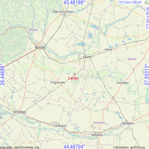
Largu GPS coordinates[2]
44° 58' 0.012" North, 27° 9' 0" East
| Map corner | latitude | longitude |
|---|---|---|
| Upper-left | 45.46199°, | 26.44688° |
| Center: | 44.96667°, | 27.15° |
| Lower-right: | 44.46704°, | 27.85313° |
| Map W x H: | 110.6×110.6 km | = 68.7×68.7mi |
| max Lat: | 48.23793° ⇑71% North |
| Largu: | 44.96667° |
| min Lat: | ⇓29% South 43.65638° |
| min Long | Largu | max Long |
| 20.31667° | 27.15° | 29.65403° |
| W 86%⇐ | ⇒14% E |
Elevation
Elevation of Largu is 48 m = 157 ft, and this is 206.9 m = 679 ft below average elevation for this country.
| Max E: |
1278 m = 4193 ft | 92.2% |
| Avg. | 254.9 m = 836 ft | |
| Largu | 48 m = 157 ft | |
Min E: |
-2 m = -7 ft | 7.8% |
See also: Romania elevation on elevation.city.
Geographical zone
Largu is located in North temperate zone (between Tropic of Cancer and the Arctic Circle). Distance of this Northern Tropic circle is 2393.9 km =1487.5 mi to South.| Distance of | km | miles | from Largu |
|---|---|---|---|
| North Pole | 5007.2 | 3111.3 | to North |
| Arctic Circle | 2401.3 | 1492.1 | to North |
| Tropic Cancer | 2393.9 | 1487.5 | to South |
| Equator | 4999.8 | 3106.7 | to South |


Nearby cities:
15 places around Largu: (largest is in red/bold)
• Bălteni
4.7 km =2.9 mi,  358°
358°
• C.a. Rosetti
8.9 km =5.5 mi,  8°
8°
• Caragele
9.2 km =5.7 mi,  278°
278°
• Cilibia
12.9 km =8 mi,  329°
329°
• Cotu Ciorii
10.7 km =6.6 mi, 356°
• Căldărăști
12.2 km =7.6 mi,  228°
228°
• Jugureanu
10.5 km =6.5 mi,  104°
104°
• Luciu
5.2 km =3.2 mi,  270°
270°
• Lunca
6.6 km =4.1 mi,  49°
49°
• Movila Oii
9.5 km =5.9 mi,  319°
319°
• Padina
15.1 km =9.4 mi,  190°
190°
• Pogoanele
13 km =8.1 mi,  244°
244°
• Ruşeţu
5.6 km =3.5 mi,  109°
109°
• Surdila-Greci
14.4 km =8.9 mi,  39°
39°
• Ulmu
13.2 km =8.2 mi, 98°
Sources, notices
• [Note1] Compared only with cities in Romania existing in our database
• [Src1] Map data: © OpenStreetMap contributors (CC-BY-SA)
• [Src2] Other city data from geonames.org with taken over terms of usage.
• [Src3] Geographical zone / Annual Mean Temperature by Robert A. Rohde @ Wikipedia
