Pogoanele geodata
Pogoanele (Buzău) is a seat of a second-order administrative division; located in Romania in Europe/Bucharest (GMT+3) time zone. With population of 7,777 people, there are 332 cities with bigger population in this country. Compared to other cities in Romania, 72.6% of cities are located further ↑North; 83% of cities are located further ←West and 89.2% of cities have higher elevation than Pogoanele. Note1


Pogoanele GPS coordinates[2]
44° 55' 0.012" North, 27° 0' 0" East
| Map corner | latitude | longitude |
|---|---|---|
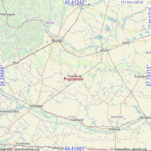
| Upper-left | 45.41242°, | 26.29688° |
| Center: | 44.91667°, | 27° |
| Lower-right: | 44.41661°, | 27.70313° |
| Map W x H: | 110.7×110.7 km | = 68.8×68.8mi |
| max Lat: | 48.23793° ⇑72.6% North |
| Pogoanele: | 44.91667° |
| min Lat: | ⇓27.4% South 43.65638° |
| min Long | Pogoanele | max Long |
| 20.31667° | 27° | 29.65403° |
| W 83%⇐ | ⇒17% E |
Elevation
Elevation of Pogoanele is 62 m = 203 ft, and this is 192.9 m = 633 ft below average elevation for this country.
| Max E: |
1278 m = 4193 ft | 89.2% |
| Avg. | 254.9 m = 836 ft | |
| Pogoanele | 62 m = 203 ft | |
Min E: |
-2 m = -7 ft | 10.8% |
See also: Romania elevation on elevation.city.
Geographical zone
Pogoanele is located in North temperate zone (between Tropic of Cancer and the Arctic Circle). Distance of this Northern Tropic circle is 2388.3 km =1484 mi to South.| Distance of | km | miles | from Pogoanele |
|---|---|---|---|
| North Pole | 5012.8 | 3114.8 | to North |
| Arctic Circle | 2406.9 | 1495.6 | to North |
| Tropic Cancer | 2388.3 | 1484 | to South |
| Equator | 4994.3 | 3103.3 | to South |


Nearby cities:
15 places around Pogoanele: (largest is in red/bold)
• Albești
10 km =6.2 mi,  324°
324°
• Brădeanu
12 km =7.5 mi,  278°
278°
• Brăgăreasa
11.6 km =7.2 mi,  207°
207°
• Bălteni
15.6 km =9.7 mi,  48°
48°
• Caragele
7.5 km =4.7 mi,  20°
20°
• Căldărăști
3.7 km =2.3 mi,  133°
133°
• Călțuna
6.5 km =4 mi, 323°
• Largu
13 km =8.1 mi,  64°
64°
• Luciu
8.6 km =5.3 mi, 49°
• Mitropolia
10.4 km =6.5 mi,  245°
245°
• Movila Oii
13.9 km =8.6 mi, 23°
• Padina
13.1 km =8.1 mi,  135°
135°
• Scutelnici
9.9 km =6.2 mi,  221°
221°
• Smeeni
13.9 km =8.6 mi,  302°
302°
• Smârdan
13.6 km =8.5 mi, 254°
Sources, notices
• [Note1] Compared only with cities in Romania existing in our database
• [Src1] Map data: © OpenStreetMap contributors (CC-BY-SA)
• [Src2] Other city data from geonames.org with taken over terms of usage.
• [Src3] Geographical zone / Annual Mean Temperature by Robert A. Rohde @ Wikipedia
