Iordăcheanu geodata
Iordăcheanu (Prahova) is a seat of a second-order administrative division; located in Romania in Europe/Bucharest (GMT+3) time zone. With population of 570 people, there are 6427 cities with bigger population in this country. Compared to other cities in Romania, 67.9% of cities are located further ↑North; 67.7% of cities are located further ←West and 64.7% of cities have higher elevation than Iordăcheanu. Note1


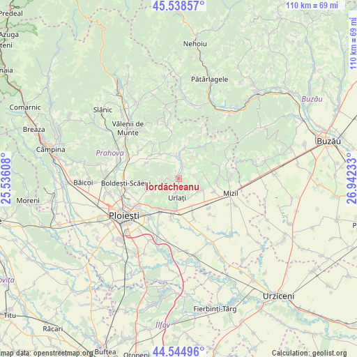
Iordăcheanu GPS coordinates[2]
45° 2' 38.112" North, 26° 14' 21.12" East
| Map corner | latitude | longitude |
|---|---|---|
| Upper-left | 45.53857°, | 25.53608° |
| Center: | 45.04392°, | 26.2392° |
| Lower-right: | 44.54496°, | 26.94233° |
| Map W x H: | 110.5×110.5 km | = 68.7×68.7mi |
| max Lat: | 48.23793° ⇑67.9% North |
| Iordăcheanu: | 45.04392° |
| min Lat: | ⇓32.1% South 43.65638° |
| min Long | Iordăcheanu | max Long |
| 20.31667° | 26.2392° | 29.65403° |
| W 67.7%⇐ | ⇒32.3% E |
Elevation
Elevation of Iordăcheanu is 148 m = 486 ft, and this is 106.9 m = 351 ft below average elevation for this country.
| Max E: |
1278 m = 4193 ft | 64.7% |
| Avg. | 254.9 m = 836 ft | |
| Iordăcheanu | 148 m = 486 ft | |
Min E: |
-2 m = -7 ft | 35.3% |
See also: Romania elevation on elevation.city.
Geographical zone
Iordăcheanu is located in North temperate zone (between Tropic of Cancer and the Arctic Circle). Distance of this North polar circle is 2392.8 km =1486.8 mi to North.| Distance of | km | miles | from Iordăcheanu |
|---|---|---|---|
| North Pole | 4998.6 | 3106 | to North |
| Arctic Circle | 2392.8 | 1486.8 | to North |
| Tropic Cancer | 2402.5 | 1492.8 | to South |
| Equator | 5008.4 | 3112.1 | to South |


Nearby cities:
15 places around Iordăcheanu: (largest is in red/bold)
• Ceptura de Sus
6.8 km =4.2 mi,  116°
116°
• Coșerele
5 km =3.1 mi,  14°
14°
• Gornet-Cricov
4.9 km =3 mi,  26°
26°
• Moceşti
1.1 km =0.7 mi,  51°
51°
• Nisipoasa
6.5 km =4 mi,  246°
246°
• Orzoaia de Jos
4.6 km =2.9 mi,  190°
190°
• Plavia
1.3 km =0.8 mi,  169°
169°
• Popești
7 km =4.3 mi,  356°
356°
• Rotari
4.6 km =2.9 mi,  73°
73°
• Urlaţi
6.8 km =4.2 mi,  183°
183°
• Valea Cucului
2.5 km =1.6 mi,  339°
339°
• Valea Pietrei
4.1 km =2.5 mi,  201°
201°
• Vărbila
3.3 km =2.1 mi,  275°
275°
• Șoimești
4.9 km =3 mi,  81°
81°
• Țărculești
3.3 km =2.1 mi,  17°
17°
Sources, notices
• [Note1] Compared only with cities in Romania existing in our database
• [Src1] Map data: © OpenStreetMap contributors (CC-BY-SA)
• [Src2] Other city data from geonames.org with taken over terms of usage.
• [Src3] Geographical zone / Annual Mean Temperature by Robert A. Rohde @ Wikipedia
