Ingărești geodata
Ingărești (Neamţ) is a populated place; located in Romania in Europe/Bucharest (GMT+3) time zone. With population of 908 people, there are 4586 cities with bigger population in this country. Compared to other cities in Romania, 83.3% of cities are located further ↓South; 73.4% of cities are located further ←West and 62.7% of cities have lower elevation than Ingărești. Note1


Ingărești GPS coordinates[2]
47° 10' 41.268" North, 26° 32' 15.684" East
| Map corner | latitude | longitude |
|---|---|---|
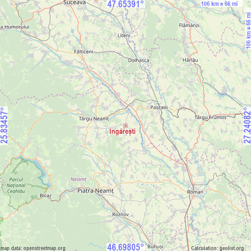
| Upper-left | 47.65391°, | 25.83457° |
| Center: | 47.17813°, | 26.53769° |
| Lower-right: | 46.69805°, | 27.24082° |
| Map W x H: | 106.3×106.3 km | = 66.1×66.1mi |
| max Lat: | 48.23793° ⇑16.7% North |
| Ingărești: | 47.17813° |
| min Lat: | ⇓83.3% South 43.65638° |
| min Long | Ingărești | max Long |
| 20.31667° | 26.53769° | 29.65403° |
| W 73.4%⇐ | ⇒26.6% E |
Elevation
Elevation of Ingărești is 278 m = 912 ft, and this is 23.1 m = 76 ft above average elevation for this country.
| Max E: |
1278 m = 4193 ft | 37.3% |
| Ingărești | 278 m 912 ft | |
| Avg. | 254.9 m = 836 ft | |
Min E: |
-2 m = -7 ft | 62.7% |
See also: Romania elevation on elevation.city.
Geographical zone
Ingărești is located in North temperate zone (between Tropic of Cancer and the Arctic Circle). Distance of this North polar circle is 2155.5 km =1339.4 mi to North.| Distance of | km | miles | from Ingărești |
|---|---|---|---|
| North Pole | 4761.3 | 2958.5 | to North |
| Arctic Circle | 2155.5 | 1339.4 | to North |
| Tropic Cancer | 2639.8 | 1640.3 | to South |
| Equator | 5245.7 | 3259.5 | to South |


Nearby cities:
15 places around Ingărești: (largest is in red/bold)
• Boiștea
8.2 km =5.1 mi,  268°
268°
• Boureni
8 km =5 mi,  61°
61°
• Davideni
7.5 km =4.7 mi,  140°
140°
• Dumbrava
7 km =4.3 mi,  306°
306°
• Miroslovești
9 km =5.6 mi,  110°
110°
• Petricani
5.5 km =3.4 mi,  256°
256°
• Plăieșu
6.8 km =4.2 mi,  335°
335°
• Preutești
8.8 km =5.5 mi,  348°
348°
• Păstrăveni
2.5 km =1.6 mi,  120°
120°
• Rădeni
4 km =2.5 mi,  180°
180°
• Soci
8.1 km =5 mi,  84°
84°
• Timişeşti
6.2 km =3.9 mi,  8°
8°
• Urecheni
2 km =1.2 mi,  231°
231°
• Ţibucani
8.7 km =5.4 mi, 182°
• Țolici
9.5 km =5.9 mi, 225°
Sources, notices
• [Note1] Compared only with cities in Romania existing in our database
• [Src1] Map data: © OpenStreetMap contributors (CC-BY-SA)
• [Src2] Other city data from geonames.org with taken over terms of usage.
• [Src3] Geographical zone / Annual Mean Temperature by Robert A. Rohde @ Wikipedia
