Ibăneşti geodata
Ibăneşti (Botoşani) is a seat of a second-order administrative division; located in Romania in Europe/Bucharest (GMT+3) time zone. With population of 4,196 people, there are 1097 cities with bigger population in this country. Compared to other cities in Romania, 99.5% of cities are located further ↓South; 70.2% of cities are located further ←West and 65.2% of cities have lower elevation than Ibăneşti. Note1


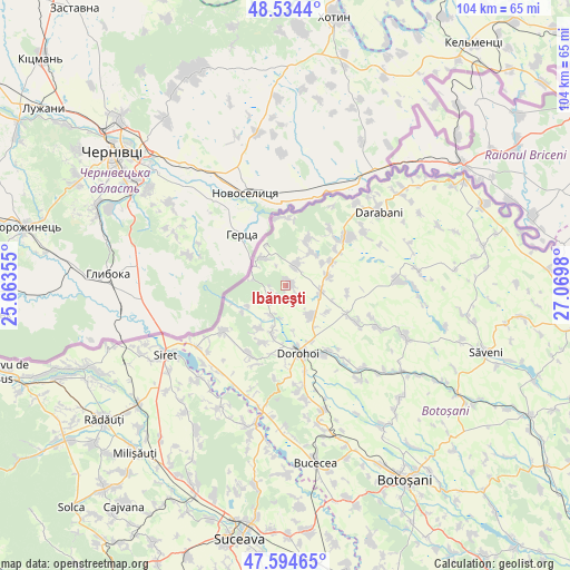
Ibăneşti GPS coordinates[2]
48° 4' 0.012" North, 26° 22' 0.012" East
| Map corner | latitude | longitude |
|---|---|---|
| Upper-left | 48.5344°, | 25.66355° |
| Center: | 48.06667°, | 26.36667° |
| Lower-right: | 47.59465°, | 27.0698° |
| Map W x H: | 104.5×104.5 km | = 64.9×64.9mi |
| max Lat: | 48.23793° ⇑0.5% North |
| Ibăneşti: | 48.06667° |
| min Lat: | ⇓99.5% South 43.65638° |
| min Long | Ibăneşti | max Long |
| 20.31667° | 26.36667° | 29.65403° |
| W 70.2%⇐ | ⇒29.8% E |
Elevation
Elevation of Ibăneşti is 291 m = 955 ft, and this is 36.1 m = 118 ft above average elevation for this country.
| Max E: |
1278 m = 4193 ft | 34.8% |
| Ibăneşti | 291 m 955 ft | |
| Avg. | 254.9 m = 836 ft | |
Min E: |
-2 m = -7 ft | 65.2% |
See also: Romania elevation on elevation.city.
Geographical zone
Ibăneşti is located in North temperate zone (between Tropic of Cancer and the Arctic Circle). Distance of this North polar circle is 2056.7 km =1278 mi to North.| Distance of | km | miles | from Ibăneşti |
|---|---|---|---|
| North Pole | 4662.5 | 2897.1 | to North |
| Arctic Circle | 2056.7 | 1278 | to North |
| Tropic Cancer | 2738.6 | 1701.7 | to South |
| Equator | 5344.5 | 3320.9 | to South |


Nearby cities:
15 places around Ibăneşti: (largest is in red/bold)
• Baranca
8.4 km =5.2 mi,  333°
333°
• Corjăuți
7.8 km =4.8 mi,  241°
241°
• Cristineşti
3.9 km =2.4 mi,  18°
18°
• Dragalina
6.7 km =4.2 mi,  99°
99°
• Dumbrăvița
7 km =4.3 mi,  139°
139°
• Fundu Herții
6.5 km =4 mi,  322°
322°
• George Enescu
9.4 km =5.8 mi,  113°
113°
• Hilişeu-Horia
9.4 km =5.8 mi,  246°
246°
• Hilișeu-Cloșca
6.2 km =3.9 mi,  202°
202°
• Hilișeu-Crișan
10.2 km =6.3 mi, 250°
• Iezer
9.6 km =6 mi,  194°
194°
• Lișna
9.3 km =5.8 mi,  61°
61°
• Pomârla
3.7 km =2.3 mi,  270°
270°
• Smârdan
7.8 km =4.8 mi,  79°
79°
• Suharău
8.3 km =5.2 mi,  26°
26°
Sources, notices
• [Note1] Compared only with cities in Romania existing in our database
• [Src1] Map data: © OpenStreetMap contributors (CC-BY-SA)
• [Src2] Other city data from geonames.org with taken over terms of usage.
• [Src3] Geographical zone / Annual Mean Temperature by Robert A. Rohde @ Wikipedia
