Hodoni geodata
Hodoni (Timiş) is a populated place; located in Romania in Europe/Bucharest (GMT+3) time zone. With population of 1,108 people, there are 3966 cities with bigger population in this country. Compared to other cities in Romania, 52.9% of cities are located further ↓South; 99% of cities are located further →East and 77.4% of cities have higher elevation than Hodoni. Note1


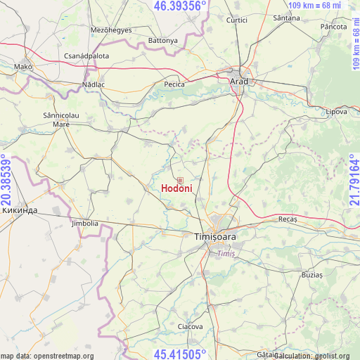
Hodoni GPS coordinates[2]
45° 54' 23.256" North, 21° 5' 18.636" East
| Map corner | latitude | longitude |
|---|---|---|
| Upper-left | 46.39356°, | 20.38539° |
| Center: | 45.90646°, | 21.08851° |
| Lower-right: | 45.41505°, | 21.79164° |
| Map W x H: | 108.8×108.8 km | = 67.6×67.6mi |
| max Lat: | 48.23793° ⇑47.1% North |
| Hodoni: | 45.90646° |
| min Lat: | ⇓52.9% South 43.65638° |
| min Long | Hodoni | max Long |
| 20.31667° | 21.08851° | 29.65403° |
| W 1%⇐ | ⇒99% E |
Elevation
Elevation of Hodoni is 103 m = 338 ft, and this is 151.9 m = 498 ft below average elevation for this country.
| Max E: |
1278 m = 4193 ft | 77.4% |
| Avg. | 254.9 m = 836 ft | |
| Hodoni | 103 m = 338 ft | |
Min E: |
-2 m = -7 ft | 22.6% |
See also: Romania elevation on elevation.city.
Geographical zone
Hodoni is located in North temperate zone (between Tropic of Cancer and the Arctic Circle). Distance of this North polar circle is 2296.9 km =1427.2 mi to North.| Distance of | km | miles | from Hodoni |
|---|---|---|---|
| North Pole | 4902.7 | 3046.4 | to North |
| Arctic Circle | 2296.9 | 1427.2 | to North |
| Tropic Cancer | 2498.4 | 1552.4 | to South |
| Equator | 5104.3 | 3171.7 | to South |


Nearby cities:
15 places around Hodoni: (largest is in red/bold)
• Becicherecu Mic
9.1 km =5.7 mi,  198°
198°
• Biled
10.3 km =6.4 mi,  257°
257°
• Bărăteaz
7 km =4.3 mi,  4°
4°
• Carani
5.3 km =3.3 mi,  84°
84°
• Cornești
10.6 km =6.6 mi,  86°
86°
• Covaci
13.8 km =8.6 mi,  125°
125°
• Călacea
6.9 km =4.3 mi,  41°
41°
• Dudeștii Noi
7.5 km =4.7 mi,  171°
171°
• Gelu
11.3 km =7 mi,  348°
348°
• Mănăștur
12 km =7.5 mi,  16°
16°
• Orţişoara
10.6 km =6.6 mi,  53°
53°
• Satchinez
5.1 km =3.2 mi,  312°
312°
• Sânandrei
8.6 km =5.3 mi, 133°
• Sânpetru Mic
14.2 km =8.8 mi,  343°
343°
• Vinga
15 km =9.3 mi, 35°
Sources, notices
• [Note1] Compared only with cities in Romania existing in our database
• [Src1] Map data: © OpenStreetMap contributors (CC-BY-SA)
• [Src2] Other city data from geonames.org with taken over terms of usage.
• [Src3] Geographical zone / Annual Mean Temperature by Robert A. Rohde @ Wikipedia
