Gura Foii geodata
Gura Foii (Dâmboviţa) is a seat of a second-order administrative division; located in Romania in Europe/Bucharest (GMT+3) time zone. With population of 2,319 people, there are 2303 cities with bigger population in this country. Compared to other cities in Romania, 78.4% of cities are located further ↑North; 51.1% of cities are located further ←West and 52.5% of cities have higher elevation than Gura Foii. Note1


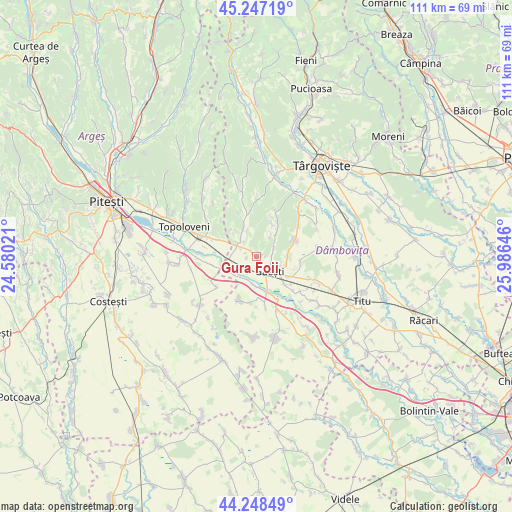
Gura Foii GPS coordinates[2]
44° 45' 0" North, 25° 16' 59.988" East
| Map corner | latitude | longitude |
|---|---|---|
| Upper-left | 45.24719°, | 24.58021° |
| Center: | 44.75°, | 25.28333° |
| Lower-right: | 44.24849°, | 25.98646° |
| Map W x H: | 111×111 km | = 69×69mi |
| max Lat: | 48.23793° ⇑78.4% North |
| Gura Foii: | 44.75° |
| min Lat: | ⇓21.6% South 43.65638° |
| min Long | Gura Foii | max Long |
| 20.31667° | 25.28333° | 29.65403° |
| W 51.1%⇐ | ⇒48.9% E |
Elevation
Elevation of Gura Foii is 199 m = 653 ft, and this is 55.9 m = 183 ft below average elevation for this country.
| Max E: |
1278 m = 4193 ft | 52.5% |
| Avg. | 254.9 m = 836 ft | |
| Gura Foii | 199 m = 653 ft | |
Min E: |
-2 m = -7 ft | 47.5% |
See also: Romania elevation on elevation.city.
Geographical zone
Gura Foii is located in North temperate zone (between Tropic of Cancer and the Arctic Circle). Distance of this Northern Tropic circle is 2369.8 km =1472.5 mi to South.| Distance of | km | miles | from Gura Foii |
|---|---|---|---|
| North Pole | 5031.3 | 3126.3 | to North |
| Arctic Circle | 2425.4 | 1507.1 | to North |
| Tropic Cancer | 2369.8 | 1472.5 | to South |
| Equator | 4975.7 | 3091.8 | to South |


Nearby cities:
15 places around Gura Foii: (largest is in red/bold)
• Bădulești
1.6 km =1 mi,  320°
320°
• Crângurile de Sus
4.4 km =2.7 mi,  295°
295°
• Dragodana
5.6 km =3.5 mi,  109°
109°
• Frasin Deal
9.1 km =5.7 mi,  19°
19°
• Gherghești
8 km =5 mi,  165°
165°
• Glâmbocata-Deal
9.1 km =5.7 mi,  293°
293°
• Găeşti
4.5 km =2.8 mi,  144°
144°
• Ionești
6.3 km =3.9 mi,  183°
183°
• Merii
8.8 km =5.5 mi,  134°
134°
• Mănăstirea
3.2 km =2 mi,  54°
54°
• Picior de Munte
9.2 km =5.7 mi,  66°
66°
• Pătroaia Vale
4.9 km =3 mi,  237°
237°
• Pătuleni
9.6 km =6 mi,  258°
258°
• Valea Caselor
6.3 km =3.9 mi,  332°
332°
• Valea Mare
5.4 km =3.4 mi,  313°
313°
Sources, notices
• [Note1] Compared only with cities in Romania existing in our database
• [Src1] Map data: © OpenStreetMap contributors (CC-BY-SA)
• [Src2] Other city data from geonames.org with taken over terms of usage.
• [Src3] Geographical zone / Annual Mean Temperature by Robert A. Rohde @ Wikipedia
