Grajduri geodata
Grajduri (Iaşi) is a seat of a second-order administrative division; located in Romania in Europe/Bucharest (GMT+3) time zone. With population of 3,264 people, there are 1579 cities with bigger population in this country. Compared to other cities in Romania, 78.2% of cities are located further ↓South; 91% of cities are located further ←West and 67.9% of cities have lower elevation than Grajduri. Note1


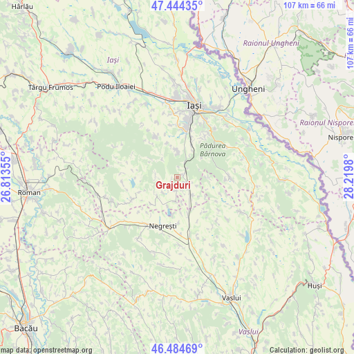
Grajduri GPS coordinates[2]
46° 58' 0.012" North, 27° 31' 0.012" East
| Map corner | latitude | longitude |
|---|---|---|
| Upper-left | 47.44435°, | 26.81355° |
| Center: | 46.96667°, | 27.51667° |
| Lower-right: | 46.48469°, | 28.2198° |
| Map W x H: | 106.7×106.7 km | = 66.3×66.3mi |
| max Lat: | 48.23793° ⇑21.8% North |
| Grajduri: | 46.96667° |
| min Lat: | ⇓78.2% South 43.65638° |
| min Long | Grajduri | max Long |
| 20.31667° | 27.51667° | 29.65403° |
| W 91%⇐ | ⇒9% E |
Elevation
Elevation of Grajduri is 306 m = 1004 ft, and this is 51.1 m = 168 ft above average elevation for this country.
| Max E: |
1278 m = 4193 ft | 32.1% |
| Grajduri | 306 m 1004 ft | |
| Avg. | 254.9 m = 836 ft | |
Min E: |
-2 m = -7 ft | 67.9% |
See also: Romania elevation on elevation.city.
Geographical zone
Grajduri is located in North temperate zone (between Tropic of Cancer and the Arctic Circle). Distance of this North polar circle is 2179 km =1354 mi to North.| Distance of | km | miles | from Grajduri |
|---|---|---|---|
| North Pole | 4784.9 | 2973.2 | to North |
| Arctic Circle | 2179 | 1354 | to North |
| Tropic Cancer | 2616.3 | 1625.7 | to South |
| Equator | 5222.2 | 3244.9 | to South |


Nearby cities:
15 places around Grajduri: (largest is in red/bold)
• Boroșești
6.5 km =4 mi,  114°
114°
• Bâcu
6.4 km =4 mi,  222°
222°
• Căuești
4.8 km =3 mi,  158°
158°
• Drăgușeni
7.3 km =4.5 mi,  182°
182°
• Frenciugi
9.3 km =5.8 mi,  198°
198°
• Hadâmbu
7.1 km =4.4 mi,  321°
321°
• Ipatele
9.4 km =5.8 mi,  233°
233°
• Mironeasa
7.6 km =4.7 mi,  270°
270°
• Mogoşeşti
7.5 km =4.7 mi,  9°
9°
• Picioru Lupului
9.2 km =5.7 mi,  30°
30°
• Protopopești
9.3 km =5.8 mi,  90°
90°
• Scânteia
6.7 km =4.2 mi,  145°
145°
• Slobozia
9.4 km =5.8 mi,  52°
52°
• Valea Satului
2.8 km =1.7 mi,  121°
121°
• Şcheia
3.7 km =2.3 mi, 180°
Sources, notices
• [Note1] Compared only with cities in Romania existing in our database
• [Src1] Map data: © OpenStreetMap contributors (CC-BY-SA)
• [Src2] Other city data from geonames.org with taken over terms of usage.
• [Src3] Geographical zone / Annual Mean Temperature by Robert A. Rohde @ Wikipedia
