Goruia geodata
Goruia (Caraş-Severin) is a seat of a second-order administrative division; located in Romania in Europe/Bucharest (GMT+3) time zone. With population of 921 people, there are 4541 cities with bigger population in this country. Compared to other cities in Romania, 62% of cities are located further ↑North; 96% of cities are located further →East and 58.7% of cities have higher elevation than Goruia. Note1


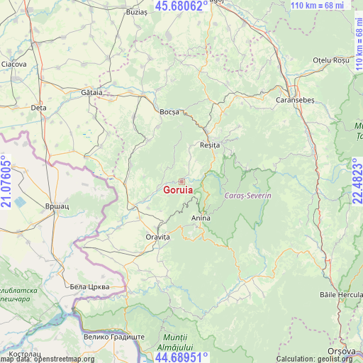
Goruia GPS coordinates[2]
45° 11' 13.992" North, 21° 46' 45.012" East
| Map corner | latitude | longitude |
|---|---|---|
| Upper-left | 45.68062°, | 21.07605° |
| Center: | 45.18722°, | 21.77917° |
| Lower-right: | 44.68951°, | 22.4823° |
| Map W x H: | 110.2×110.2 km | = 68.5×68.5mi |
| max Lat: | 48.23793° ⇑62% North |
| Goruia: | 45.18722° |
| min Lat: | ⇓38% South 43.65638° |
| min Long | Goruia | max Long |
| 20.31667° | 21.77917° | 29.65403° |
| W 4%⇐ | ⇒96% E |
Elevation
Elevation of Goruia is 171 m = 561 ft, and this is 83.9 m = 275 ft below average elevation for this country.
| Max E: |
1278 m = 4193 ft | 58.7% |
| Avg. | 254.9 m = 836 ft | |
| Goruia | 171 m = 561 ft | |
Min E: |
-2 m = -7 ft | 41.3% |
See also: Romania elevation on elevation.city.
Geographical zone
Goruia is located in North temperate zone (between Tropic of Cancer and the Arctic Circle). Distance of this North polar circle is 2376.8 km =1476.9 mi to North.| Distance of | km | miles | from Goruia |
|---|---|---|---|
| North Pole | 4982.7 | 3096.1 | to North |
| Arctic Circle | 2376.8 | 1476.9 | to North |
| Tropic Cancer | 2418.4 | 1502.7 | to South |
| Equator | 5024.3 | 3122 | to South |


Nearby cities:
15 places around Goruia: (largest is in red/bold)
• Anina
13.4 km =8.3 mi,  153°
153°
• Brădișoru de Jos
13.1 km =8.1 mi,  202°
202°
• Caraşova
7.2 km =4.5 mi,  79°
79°
• Ciudanoviţa
4.9 km =3 mi,  162°
162°
• Clocotici
7.8 km =4.8 mi,  34°
34°
• Doclin
15.7 km =9.8 mi,  321°
321°
• Dognecea
9.8 km =6.1 mi,  349°
349°
• Doman
13.8 km =8.6 mi,  51°
51°
• Forotic
15.8 km =9.8 mi,  287°
287°
• Lupac
10.6 km =6.6 mi,  14°
14°
• Nermed
8.1 km =5 mi, 54°
• Rafnic
5.2 km =3.2 mi, 8°
• Reşiţa
15.3 km =9.5 mi, 34°
• Steierdorf
14.9 km =9.3 mi, 157°
• Ticvaniu Mare
12.5 km =7.8 mi,  242°
242°
Sources, notices
• [Note1] Compared only with cities in Romania existing in our database
• [Src1] Map data: © OpenStreetMap contributors (CC-BY-SA)
• [Src2] Other city data from geonames.org with taken over terms of usage.
• [Src3] Geographical zone / Annual Mean Temperature by Robert A. Rohde @ Wikipedia
