Ghimpați geodata
Ghimpați (Giurgiu) is a seat of a second-order administrative division; located in Romania in Europe/Bucharest (GMT+3) time zone. With population of 2,698 people, there are 1981 cities with bigger population in this country. Compared to other cities in Romania, 93.4% of cities are located further ↑North; 58.9% of cities are located further ←West and 84.7% of cities have higher elevation than Ghimpați. Note1


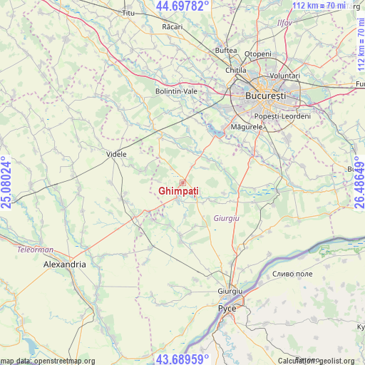
Ghimpați GPS coordinates[2]
44° 11' 45.096" North, 25° 47' 0.096" East
| Map corner | latitude | longitude |
|---|---|---|
| Upper-left | 44.69782°, | 25.08024° |
| Center: | 44.19586°, | 25.78336° |
| Lower-right: | 43.68959°, | 26.48649° |
| Map W x H: | 112.1×112.1 km | = 69.7×69.7mi |
| max Lat: | 48.23793° ⇑93.4% North |
| Ghimpați: | 44.19586° |
| min Lat: | ⇓6.6% South 43.65638° |
| min Long | Ghimpați | max Long |
| 20.31667° | 25.78336° | 29.65403° |
| W 58.9%⇐ | ⇒41.1% E |
Elevation
Elevation of Ghimpați is 79 m = 259 ft, and this is 175.9 m = 577 ft below average elevation for this country.
| Max E: |
1278 m = 4193 ft | 84.7% |
| Avg. | 254.9 m = 836 ft | |
| Ghimpați | 79 m = 259 ft | |
Min E: |
-2 m = -7 ft | 15.3% |
See also: Romania elevation on elevation.city.
Geographical zone
Ghimpați is located in North temperate zone (between Tropic of Cancer and the Arctic Circle). Distance of this Northern Tropic circle is 2308.2 km =1434.2 mi to South.| Distance of | km | miles | from Ghimpați |
|---|---|---|---|
| North Pole | 5092.9 | 3164.6 | to North |
| Arctic Circle | 2487.1 | 1545.4 | to North |
| Tropic Cancer | 2308.2 | 1434.2 | to South |
| Equator | 4914.1 | 3053.5 | to South |


Nearby cities:
15 places around Ghimpați: (largest is in red/bold)
• Bila
6.2 km =3.9 mi,  117°
117°
• Bulbucata
9.9 km =6.2 mi,  9°
9°
• Ciuani
11.4 km =7.1 mi,  291°
291°
• Copaciu
1.9 km =1.2 mi,  215°
215°
• Cămineasca
3.9 km =2.4 mi,  135°
135°
• Gorneni
11.6 km =7.2 mi,  34°
34°
• Iepureşti
10.5 km =6.5 mi,  48°
48°
• Letca Nouă
5.4 km =3.4 mi,  323°
323°
• Letca Veche
7.7 km =4.8 mi,  272°
272°
• Milcovățu
10.3 km =6.4 mi, 319°
• Naipu
5.2 km =3.2 mi,  199°
199°
• Prunaru
11.5 km =7.1 mi,  225°
225°
• Schitu
7.5 km =4.7 mi,  145°
145°
• Stoeneşti
10.6 km =6.6 mi, 122°
• Valea Plopilor
5.7 km =3.5 mi, 30°
Sources, notices
• [Note1] Compared only with cities in Romania existing in our database
• [Src1] Map data: © OpenStreetMap contributors (CC-BY-SA)
• [Src2] Other city data from geonames.org with taken over terms of usage.
• [Src3] Geographical zone / Annual Mean Temperature by Robert A. Rohde @ Wikipedia
