Făurești geodata
Făurești (Maramureş) is a populated place; located in Romania in Europe/Bucharest (GMT+3) time zone. With population of 816 people, there are 4966 cities with bigger population in this country. Compared to other cities in Romania, 92.2% of cities are located further ↓South; 73.3% of cities are located further →East and 70.4% of cities have lower elevation than Făurești. Note1


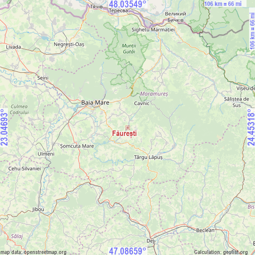
Făurești GPS coordinates[2]
47° 33' 47.484" North, 23° 45' 0.18" East
| Map corner | latitude | longitude |
|---|---|---|
| Upper-left | 48.03549°, | 23.04693° |
| Center: | 47.56319°, | 23.75005° |
| Lower-right: | 47.08659°, | 24.45318° |
| Map W x H: | 105.5×105.5 km | = 65.6×65.6mi |
| max Lat: | 48.23793° ⇑7.8% North |
| Făurești: | 47.56319° |
| min Lat: | ⇓92.2% South 43.65638° |
| min Long | Făurești | max Long |
| 20.31667° | 23.75005° | 29.65403° |
| W 26.7%⇐ | ⇒73.3% E |
Elevation
Elevation of Făurești is 324 m = 1063 ft, and this is 69.1 m = 227 ft above average elevation for this country.
| Max E: |
1278 m = 4193 ft | 29.6% |
| Făurești | 324 m 1063 ft | |
| Avg. | 254.9 m = 836 ft | |
Min E: |
-2 m = -7 ft | 70.4% |
See also: Romania elevation on elevation.city.
Geographical zone
Făurești is located in North temperate zone (between Tropic of Cancer and the Arctic Circle). Distance of this North polar circle is 2112.6 km =1312.7 mi to North.| Distance of | km | miles | from Făurești |
|---|---|---|---|
| North Pole | 4718.5 | 2931.9 | to North |
| Arctic Circle | 2112.6 | 1312.7 | to North |
| Tropic Cancer | 2682.6 | 1666.9 | to South |
| Equator | 5288.5 | 3286.1 | to South |


Nearby cities:
15 places around Făurești: (largest is in red/bold)
• Berința
6 km =3.7 mi,  245°
245°
• Cerneşti
5.2 km =3.2 mi,  180°
180°
• Cetățele
4 km =2.5 mi,  348°
348°
• Ciocotiș
3.6 km =2.2 mi,  101°
101°
• Copalnic
8.5 km =5.3 mi,  236°
236°
• Cărbunari
8.1 km =5 mi,  279°
279°
• Dănești
6.4 km =4 mi, 348°
• Fânațe
3.5 km =2.2 mi,  159°
159°
• Lăschia
2.6 km =1.6 mi,  211°
211°
• Negreia
8 km =5 mi,  356°
356°
• Plopiș
3.4 km =2.1 mi,  30°
30°
• Rus
8.2 km =5.1 mi,  312°
312°
• Trestia
3.3 km =2.1 mi,  86°
86°
• Șindrești
6.3 km =3.9 mi,  319°
319°
• Șurdești
4.6 km =2.9 mi,  18°
18°
Sources, notices
• [Note1] Compared only with cities in Romania existing in our database
• [Src1] Map data: © OpenStreetMap contributors (CC-BY-SA)
• [Src2] Other city data from geonames.org with taken over terms of usage.
• [Src3] Geographical zone / Annual Mean Temperature by Robert A. Rohde @ Wikipedia
