Ferice geodata
Ferice (Bihor) is a populated place; located in Romania in Europe/Bucharest (GMT+3) time zone. With population of 623 people, there are 6062 cities with bigger population in this country. Compared to other cities in Romania, 70.3% of cities are located further ↓South; 89.6% of cities are located further →East and 77.6% of cities have lower elevation than Ferice. Note1


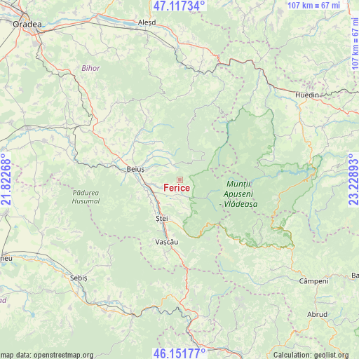
Ferice GPS coordinates[2]
46° 38' 12.156" North, 22° 31' 32.88" East
| Map corner | latitude | longitude |
|---|---|---|
| Upper-left | 47.11734°, | 21.82268° |
| Center: | 46.63671°, | 22.5258° |
| Lower-right: | 46.15177°, | 23.22893° |
| Map W x H: | 107.4×107.4 km | = 66.7×66.7mi |
| max Lat: | 48.23793° ⇑29.7% North |
| Ferice: | 46.63671° |
| min Lat: | ⇓70.3% South 43.65638° |
| min Long | Ferice | max Long |
| 20.31667° | 22.5258° | 29.65403° |
| W 10.4%⇐ | ⇒89.6% E |
Elevation
Elevation of Ferice is 372 m = 1220 ft, and this is 117.1 m = 384 ft above average elevation for this country.
| Max E: |
1278 m = 4193 ft | 22.4% |
| Ferice | 372 m 1220 ft | |
| Avg. | 254.9 m = 836 ft | |
Min E: |
-2 m = -7 ft | 77.6% |
See also: Romania elevation on elevation.city.
Geographical zone
Ferice is located in North temperate zone (between Tropic of Cancer and the Arctic Circle). Distance of this North polar circle is 2215.7 km =1376.8 mi to North.| Distance of | km | miles | from Ferice |
|---|---|---|---|
| North Pole | 4821.5 | 2995.9 | to North |
| Arctic Circle | 2215.7 | 1376.8 | to North |
| Tropic Cancer | 2579.6 | 1602.9 | to South |
| Equator | 5185.5 | 3222.1 | to South |


Nearby cities:
15 places around Ferice: (largest is in red/bold)
• Beiușele
10.7 km =6.6 mi,  327°
327°
• Brădet
6 km =3.7 mi,  175°
175°
• Budureasa
3.9 km =2.4 mi, 329°
• Bunteşti
5 km =3.1 mi,  243°
243°
• Cresuia
8.7 km =5.4 mi,  337°
337°
• Curăţele
10.9 km =6.8 mi,  310°
310°
• Drăgăneşti
11.1 km =6.9 mi,  258°
258°
• Gurani
4.9 km =3 mi,  161°
161°
• Lelești
5.6 km =3.5 mi,  250°
250°
• Petrileni
10.8 km =6.7 mi,  213°
213°
• Pietroasa
6.2 km =3.9 mi, 162°
• Poienii de Jos
3.7 km =2.3 mi, 211°
• Poienii de Sus
3.3 km =2.1 mi,  191°
191°
• Rieni
9.2 km =5.7 mi,  221°
221°
• Valea de Jos
7.8 km =4.8 mi,  202°
202°
Sources, notices
• [Note1] Compared only with cities in Romania existing in our database
• [Src1] Map data: © OpenStreetMap contributors (CC-BY-SA)
• [Src2] Other city data from geonames.org with taken over terms of usage.
• [Src3] Geographical zone / Annual Mean Temperature by Robert A. Rohde @ Wikipedia
