Eriu-Sâncrai geodata
Eriu-Sâncrai (Satu Mare) is a populated place; located in Romania in Europe/Bucharest (GMT+3) time zone. With population of 651 people, there are 5880 cities with bigger population in this country. Compared to other cities in Romania, 92.7% of cities are located further ↓South; 88.5% of cities are located further →East and 70.9% of cities have higher elevation than Eriu-Sâncrai. Note1


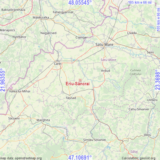
Eriu-Sâncrai GPS coordinates[2]
47° 34' 59.988" North, 22° 40' 0.012" East
| Map corner | latitude | longitude |
|---|---|---|
| Upper-left | 48.05545°, | 21.96355° |
| Center: | 47.58333°, | 22.66667° |
| Lower-right: | 47.10691°, | 23.3698° |
| Map W x H: | 105.5×105.5 km | = 65.6×65.6mi |
| max Lat: | 48.23793° ⇑7.3% North |
| Eriu-Sâncrai: | 47.58333° |
| min Lat: | ⇓92.7% South 43.65638° |
| min Long | Eriu-Sâncrai | max Long |
| 20.31667° | 22.66667° | 29.65403° |
| W 11.5%⇐ | ⇒88.5% E |
Elevation
Elevation of Eriu-Sâncrai is 124 m = 407 ft, and this is 130.9 m = 429 ft below average elevation for this country.
| Max E: |
1278 m = 4193 ft | 70.9% |
| Avg. | 254.9 m = 836 ft | |
| Eriu-Sâncrai | 124 m = 407 ft | |
Min E: |
-2 m = -7 ft | 29.1% |
See also: Romania elevation on elevation.city.
Geographical zone
Eriu-Sâncrai is located in North temperate zone (between Tropic of Cancer and the Arctic Circle). Distance of this North polar circle is 2110.4 km =1311.3 mi to North.| Distance of | km | miles | from Eriu-Sâncrai |
|---|---|---|---|
| North Pole | 4716.3 | 2930.6 | to North |
| Arctic Circle | 2110.4 | 1311.3 | to North |
| Tropic Cancer | 2684.9 | 1668.3 | to South |
| Equator | 5290.8 | 3287.5 | to South |


Nearby cities:
15 places around Eriu-Sâncrai: (largest is in red/bold)
• Acâş
10.4 km =6.5 mi,  122°
122°
• Baba Novac
12 km =7.5 mi,  52°
52°
• Cig
6.4 km =4 mi,  198°
198°
• Craidorolţ
4.5 km =2.8 mi,  33°
33°
• Căuaş
8.9 km =5.5 mi,  258°
258°
• Ghirișa
9.6 km =6 mi,  81°
81°
• Mihăieni
5.7 km =3.5 mi,  113°
113°
• Moftinu Mare
9.3 km =5.8 mi,  0°
0°
• Moftinu Mic
12.5 km =7.8 mi,  336°
336°
• Pișcari
9.2 km =5.7 mi, 32°
• Săcăşeni
11.2 km =7 mi,  173°
173°
• Sărăuad
12 km =7.5 mi,  194°
194°
• Terebeşti
11.7 km =7.3 mi,  18°
18°
• Tăşnad
12.8 km =8 mi,  209°
209°
• Unimăt
10.5 km =6.5 mi,  145°
145°
Sources, notices
• [Note1] Compared only with cities in Romania existing in our database
• [Src1] Map data: © OpenStreetMap contributors (CC-BY-SA)
• [Src2] Other city data from geonames.org with taken over terms of usage.
• [Src3] Geographical zone / Annual Mean Temperature by Robert A. Rohde @ Wikipedia
