Dumitra geodata
Dumitra (Bistriţa-Năsăud) is a seat of a second-order administrative division; located in Romania in Europe/Bucharest (GMT+3) time zone. With population of 4,482 people, there are 961 cities with bigger population in this country. Compared to other cities in Romania, 84.4% of cities are located further ↓South; 60.5% of cities are located further →East and 85.2% of cities have lower elevation than Dumitra. Note1


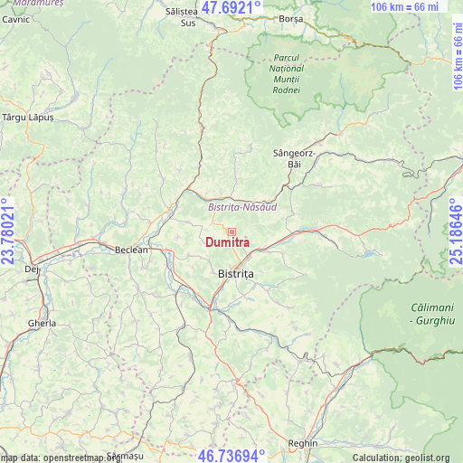
Dumitra GPS coordinates[2]
47° 13' 0.012" North, 24° 28' 59.988" East
| Map corner | latitude | longitude |
|---|---|---|
| Upper-left | 47.6921°, | 23.78021° |
| Center: | 47.21667°, | 24.48333° |
| Lower-right: | 46.73694°, | 25.18646° |
| Map W x H: | 106.2×106.2 km | = 66×66mi |
| max Lat: | 48.23793° ⇑15.6% North |
| Dumitra: | 47.21667° |
| min Lat: | ⇓84.4% South 43.65638° |
| min Long | Dumitra | max Long |
| 20.31667° | 24.48333° | 29.65403° |
| W 39.5%⇐ | ⇒60.5% E |
Elevation
Elevation of Dumitra is 448 m = 1470 ft, and this is 193.1 m = 634 ft above average elevation for this country.
| Max E: |
1278 m = 4193 ft | 14.8% |
| Dumitra | 448 m 1470 ft | |
| Avg. | 254.9 m = 836 ft | |
Min E: |
-2 m = -7 ft | 85.2% |
See also: Romania elevation on elevation.city.
Geographical zone
Dumitra is located in North temperate zone (between Tropic of Cancer and the Arctic Circle). Distance of this North polar circle is 2151.2 km =1336.7 mi to North.| Distance of | km | miles | from Dumitra |
|---|---|---|---|
| North Pole | 4757.1 | 2955.9 | to North |
| Arctic Circle | 2151.2 | 1336.7 | to North |
| Tropic Cancer | 2644.1 | 1643 | to South |
| Equator | 5250 | 3262.2 | to South |


Nearby cities:
15 places around Dumitra: (largest is in red/bold)
• Bistriţa
9.4 km =5.8 mi,  172°
172°
• Feldru
11.5 km =7.1 mi,  49°
49°
• Ghinda
11.2 km =7 mi,  142°
142°
• Livezile
7.3 km =4.5 mi,  120°
120°
• Liviu Rebreanu
6.7 km =4.2 mi,  325°
325°
• Lușca
9 km =5.6 mi,  320°
320°
• Nepos
7.7 km =4.8 mi,  29°
29°
• Năsăud
9.7 km =6 mi, 319°
• Rebra
11.2 km =7 mi,  6°
6°
• Rebrişoara
7.8 km =4.8 mi,  341°
341°
• Rusu Bârgăului
12 km =7.5 mi,  100°
100°
• Sigmir
10 km =6.2 mi,  204°
204°
• Slătinița
3.6 km =2.2 mi,  112°
112°
• Tărpiu
6.5 km =4 mi,  245°
245°
• Unirea
7.2 km =4.5 mi,  150°
150°
Sources, notices
• [Note1] Compared only with cities in Romania existing in our database
• [Src1] Map data: © OpenStreetMap contributors (CC-BY-SA)
• [Src2] Other city data from geonames.org with taken over terms of usage.
• [Src3] Geographical zone / Annual Mean Temperature by Robert A. Rohde @ Wikipedia
