Dragosloveni geodata
Dragosloveni (Vrancea) is a populated place; located in Romania in Europe/Bucharest (GMT+3) time zone. With population of 2,747 people, there are 1949 cities with bigger population in this country. Compared to other cities in Romania, 55% of cities are located further ↓South; 75.9% of cities are located further ←West and 90.3% of cities have lower elevation than Dragosloveni. Note1


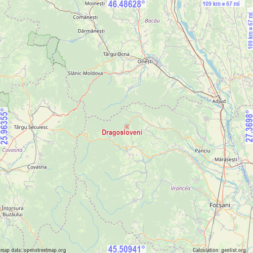
Dragosloveni GPS coordinates[2]
46° 0' 0" North, 26° 40' 0.012" East
| Map corner | latitude | longitude |
|---|---|---|
| Upper-left | 46.48628°, | 25.96355° |
| Center: | 46°, | 26.66667° |
| Lower-right: | 45.50941°, | 27.3698° |
| Map W x H: | 108.6×108.6 km | = 67.5×67.5mi |
| max Lat: | 48.23793° ⇑45% North |
| Dragosloveni: | 46° |
| min Lat: | ⇓55% South 43.65638° |
| min Long | Dragosloveni | max Long |
| 20.31667° | 26.66667° | 29.65403° |
| W 75.9%⇐ | ⇒24.1% E |
Elevation
Elevation of Dragosloveni is 518 m = 1699 ft, and this is 263.1 m = 863 ft above average elevation for this country.
| Max E: |
1278 m = 4193 ft | 9.7% |
| Dragosloveni | 518 m 1699 ft | |
| Avg. | 254.9 m = 836 ft | |
Min E: |
-2 m = -7 ft | 90.3% |
See also: Romania elevation on elevation.city.
Geographical zone
Dragosloveni is located in North temperate zone (between Tropic of Cancer and the Arctic Circle). Distance of this North polar circle is 2286.5 km =1420.8 mi to North.| Distance of | km | miles | from Dragosloveni |
|---|---|---|---|
| North Pole | 4892.3 | 3039.9 | to North |
| Arctic Circle | 2286.5 | 1420.8 | to North |
| Tropic Cancer | 2508.8 | 1558.9 | to South |
| Equator | 5114.7 | 3178.1 | to South |


Nearby cities:
15 places around Dragosloveni: (largest is in red/bold)
• Bârseşti
10.6 km =6.6 mi,  150°
150°
• Coza
10.2 km =6.3 mi,  178°
178°
• Câmpuri
9.5 km =5.9 mi,  79°
79°
• Câmpurile de Jos
9.2 km =5.7 mi, 78°
• Fetești
8.2 km =5.1 mi,  57°
57°
• Hăulișca
13.1 km =8.1 mi,  173°
173°
• Negrilești
7.6 km =4.7 mi,  156°
156°
• Piscu Radului
11.6 km =7.2 mi,  111°
111°
• Păulești
12.2 km =7.6 mi, 171°
• Rucăreni
1.1 km =0.7 mi,  235°
235°
• Spinești
12.3 km =7.6 mi, 165°
• Topești
12.4 km =7.7 mi, 147°
• Tulnici
9.3 km =5.8 mi, 180°
• Vizantea Răzășească
11.9 km =7.4 mi, 106°
• Vizantea-Mânăstirească
9.2 km =5.7 mi,  101°
101°
Sources, notices
• [Note1] Compared only with cities in Romania existing in our database
• [Src1] Map data: © OpenStreetMap contributors (CC-BY-SA)
• [Src2] Other city data from geonames.org with taken over terms of usage.
• [Src3] Geographical zone / Annual Mean Temperature by Robert A. Rohde @ Wikipedia
