Dioșod geodata
Dioșod (Sălaj) is a populated place; located in Romania in Europe/Bucharest (GMT+3) time zone. With population of 1,129 people, there are 3908 cities with bigger population in this country. Compared to other cities in Romania, 86.4% of cities are located further ↓South; 84.1% of cities are located further →East and 60.7% of cities have lower elevation than Dioșod. Note1


Dioșod GPS coordinates[2]
47° 17' 32.568" North, 23° 1' 15.564" East
| Map corner | latitude | longitude |
|---|---|---|
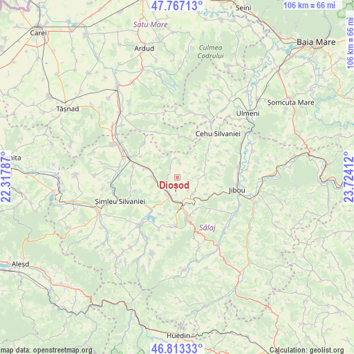
| Upper-left | 47.76713°, | 22.31787° |
| Center: | 47.29238°, | 23.02099° |
| Lower-right: | 46.81333°, | 23.72412° |
| Map W x H: | 106.1×106.1 km | = 65.9×65.9mi |
| max Lat: | 48.23793° ⇑13.6% North |
| Dioșod: | 47.29238° |
| min Lat: | ⇓86.4% South 43.65638° |
| min Long | Dioșod | max Long |
| 20.31667° | 23.02099° | 29.65403° |
| W 15.9%⇐ | ⇒84.1% E |
Elevation
Elevation of Dioșod is 267 m = 876 ft, and this is 12.1 m = 40 ft above average elevation for this country.
| Max E: |
1278 m = 4193 ft | 39.3% |
| Dioșod | 267 m 876 ft | |
| Avg. | 254.9 m = 836 ft | |
Min E: |
-2 m = -7 ft | 60.7% |
See also: Romania elevation on elevation.city.
Geographical zone
Dioșod is located in North temperate zone (between Tropic of Cancer and the Arctic Circle). Distance of this North polar circle is 2142.8 km =1331.5 mi to North.| Distance of | km | miles | from Dioșod |
|---|---|---|---|
| North Pole | 4748.6 | 2950.6 | to North |
| Arctic Circle | 2142.8 | 1331.5 | to North |
| Tropic Cancer | 2652.5 | 1648.2 | to South |
| Equator | 5258.4 | 3267.4 | to South |


Nearby cities:
15 places around Dioșod: (largest is in red/bold)
• Archid
5.9 km =3.7 mi,  354°
354°
• Badon
5.7 km =3.5 mi,  214°
214°
• Bocşa
8.1 km =5 mi,  271°
271°
• Coşeiu
3.9 km =2.4 mi,  313°
313°
• Cristur Crișeni
6.7 km =4.2 mi,  122°
122°
• Crişeni
6.9 km =4.3 mi,  161°
161°
• Doba
5.7 km =3.5 mi,  91°
91°
• Dobrin
8.5 km =5.3 mi,  96°
96°
• Guruslău
3.3 km =2.1 mi,  240°
240°
• Hereclean
4.7 km =2.9 mi,  183°
183°
• Lelei
9.9 km =6.2 mi,  20°
20°
• Panic
9.9 km =6.2 mi,  192°
192°
• Sălăjeni
9.3 km =5.8 mi,  289°
289°
• Zalău
10.5 km =6.5 mi,  167°
167°
• Şamşud
8.3 km =5.2 mi,  320°
320°
Sources, notices
• [Note1] Compared only with cities in Romania existing in our database
• [Src1] Map data: © OpenStreetMap contributors (CC-BY-SA)
• [Src2] Other city data from geonames.org with taken over terms of usage.
• [Src3] Geographical zone / Annual Mean Temperature by Robert A. Rohde @ Wikipedia
