Dâlga geodata
Dâlga (Călăraşi) is a populated place; located in Romania in Europe/Bucharest (GMT+3) time zone. With population of 707 people, there are 5524 cities with bigger population in this country. Compared to other cities in Romania, 87% of cities are located further ↑North; 84.5% of cities are located further ←West and 91.8% of cities have higher elevation than Dâlga. Note1


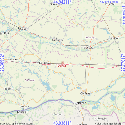
Dâlga GPS coordinates[2]
44° 26' 32.172" North, 27° 4' 22.944" East
| Map corner | latitude | longitude |
|---|---|---|
| Upper-left | 44.94211°, | 26.36992° |
| Center: | 44.44227°, | 27.07304° |
| Lower-right: | 43.93811°, | 27.77617° |
| Map W x H: | 111.6×111.6 km | = 69.3×69.3mi |
| max Lat: | 48.23793° ⇑87% North |
| Dâlga: | 44.44227° |
| min Lat: | ⇓13% South 43.65638° |
| min Long | Dâlga | max Long |
| 20.31667° | 27.07304° | 29.65403° |
| W 84.5%⇐ | ⇒15.5% E |
Elevation
Elevation of Dâlga is 49 m = 161 ft, and this is 205.9 m = 676 ft below average elevation for this country.
| Max E: |
1278 m = 4193 ft | 91.8% |
| Avg. | 254.9 m = 836 ft | |
| Dâlga | 49 m = 161 ft | |
Min E: |
-2 m = -7 ft | 8.2% |
See also: Romania elevation on elevation.city.
Geographical zone
Dâlga is located in North temperate zone (between Tropic of Cancer and the Arctic Circle). Distance of this Northern Tropic circle is 2335.6 km =1451.3 mi to South.| Distance of | km | miles | from Dâlga |
|---|---|---|---|
| North Pole | 5065.5 | 3147.6 | to North |
| Arctic Circle | 2459.7 | 1528.4 | to North |
| Tropic Cancer | 2335.6 | 1451.3 | to South |
| Equator | 4941.5 | 3070.5 | to South |


Nearby cities:
15 places around Dâlga: (largest is in red/bold)
• Albeşti
11.2 km =7 mi,  25°
25°
• Andrăşeşti
14.6 km =9.1 mi,  19°
19°
• Bordușelu
12.9 km =8 mi,  349°
349°
• Buești
14.6 km =9.1 mi,  38°
38°
• Dor Mărunt
12.4 km =7.7 mi,  273°
273°
• Dragoș Vodă
6.2 km =3.9 mi,  99°
99°
• Dâlga-Gară
2.1 km =1.3 mi,  241°
241°
• Floroaica
12.6 km =7.8 mi,  136°
136°
• Marsilieni
11 km =6.8 mi,  7°
7°
• Mihai Viteazu
10.4 km =6.5 mi,  179°
179°
• Nucetu
14.7 km =9.1 mi,  248°
248°
• Plevna
10.7 km =6.6 mi,  215°
215°
• Radu Vodă
13.3 km =8.3 mi, 241°
• Vlad Ţepeş
10.3 km =6.4 mi, 175°
• Vâlcelele
8.6 km =5.3 mi,  134°
134°
Sources, notices
• [Note1] Compared only with cities in Romania existing in our database
• [Src1] Map data: © OpenStreetMap contributors (CC-BY-SA)
• [Src2] Other city data from geonames.org with taken over terms of usage.
• [Src3] Geographical zone / Annual Mean Temperature by Robert A. Rohde @ Wikipedia
