Cutuș geodata
Cutuș (Braşov) is a populated place; located in Romania in Europe/Bucharest (GMT+3) time zone. With population of 525 people, there are 6818 cities with bigger population in this country. Compared to other cities in Romania, 50.9% of cities are located further ↓South; 54.2% of cities are located further ←West and 93% of cities have lower elevation than Cutuș. Note1


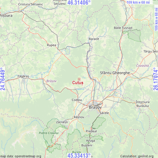
Cutuș GPS coordinates[2]
45° 49' 34.5" North, 25° 28' 3.396" East
| Map corner | latitude | longitude |
|---|---|---|
| Upper-left | 46.31406°, | 24.76449° |
| Center: | 45.82625°, | 25.46761° |
| Lower-right: | 45.33413°, | 26.17074° |
| Map W x H: | 109×109 km | = 67.7×67.7mi |
| max Lat: | 48.23793° ⇑49.1% North |
| Cutuș: | 45.82625° |
| min Lat: | ⇓50.9% South 43.65638° |
| min Long | Cutuș | max Long |
| 20.31667° | 25.46761° | 29.65403° |
| W 54.2%⇐ | ⇒45.8% E |
Elevation
Elevation of Cutuș is 570 m = 1870 ft, and this is 315.1 m = 1034 ft above average elevation for this country.
| Max E: |
1278 m = 4193 ft | 7% |
| Cutuș | 570 m 1870 ft | |
| Avg. | 254.9 m = 836 ft | |
Min E: |
-2 m = -7 ft | 93% |
See also: Romania elevation on elevation.city.
Geographical zone
Cutuș is located in North temperate zone (between Tropic of Cancer and the Arctic Circle). Distance of this North polar circle is 2305.8 km =1432.8 mi to North.| Distance of | km | miles | from Cutuș |
|---|---|---|---|
| North Pole | 4911.7 | 3052 | to North |
| Arctic Circle | 2305.8 | 1432.8 | to North |
| Tropic Cancer | 2489.5 | 1546.9 | to South |
| Equator | 5095.4 | 3166.1 | to South |


Nearby cities:
15 places around Cutuș: (largest is in red/bold)
• Apaţa
14.3 km =8.9 mi,  15°
15°
• Araci
14.6 km =9.1 mi,  96°
96°
• Arini
10.2 km =6.3 mi,  48°
48°
• Belin
14.2 km =8.8 mi,  32°
32°
• Codlea
14.1 km =8.8 mi,  185°
185°
• Colonia Bod
12.9 km =8 mi,  127°
127°
• Colonia Reconstrucția
8 km =5 mi,  89°
89°
• Crizbav
1.2 km =0.7 mi,  181°
181°
• Dumbrăviţa
7.1 km =4.4 mi,  201°
201°
• Feldioara
10.3 km =6.4 mi, 95°
• Hăghig
9 km =5.6 mi,  84°
84°
• Hălchiu
9.2 km =5.7 mi,  136°
136°
• Măieruş
9.7 km =6 mi, 31°
• Rotbav
7.1 km =4.4 mi, 78°
• Vlădeni
9.9 km =6.2 mi,  228°
228°
Sources, notices
• [Note1] Compared only with cities in Romania existing in our database
• [Src1] Map data: © OpenStreetMap contributors (CC-BY-SA)
• [Src2] Other city data from geonames.org with taken over terms of usage.
• [Src3] Geographical zone / Annual Mean Temperature by Robert A. Rohde @ Wikipedia
