Cunța geodata
Cunța (Alba) is a populated place; located in Romania in Europe/Bucharest (GMT+3) time zone. With population of 597 people, there are 6225 cities with bigger population in this country. Compared to other cities in Romania, 53.4% of cities are located further ↓South; 73.9% of cities are located further →East and 62.7% of cities have lower elevation than Cunța. Note1


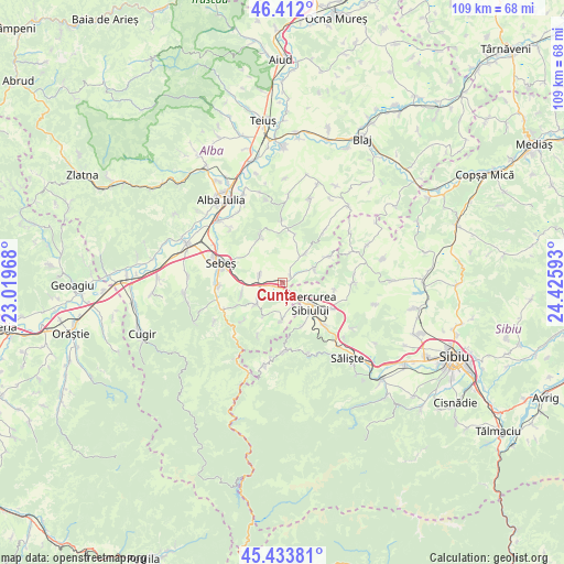
Cunța GPS coordinates[2]
45° 55' 30.216" North, 23° 43' 22.08" East
| Map corner | latitude | longitude |
|---|---|---|
| Upper-left | 46.412°, | 23.01968° |
| Center: | 45.92506°, | 23.7228° |
| Lower-right: | 45.43381°, | 24.42593° |
| Map W x H: | 108.8×108.8 km | = 67.6×67.6mi |
| max Lat: | 48.23793° ⇑46.6% North |
| Cunța: | 45.92506° |
| min Lat: | ⇓53.4% South 43.65638° |
| min Long | Cunța | max Long |
| 20.31667° | 23.7228° | 29.65403° |
| W 26.1%⇐ | ⇒73.9% E |
Elevation
Elevation of Cunța is 278 m = 912 ft, and this is 23.1 m = 76 ft above average elevation for this country.
| Max E: |
1278 m = 4193 ft | 37.3% |
| Cunța | 278 m 912 ft | |
| Avg. | 254.9 m = 836 ft | |
Min E: |
-2 m = -7 ft | 62.7% |
See also: Romania elevation on elevation.city.
Geographical zone
Cunța is located in North temperate zone (between Tropic of Cancer and the Arctic Circle). Distance of this North polar circle is 2294.8 km =1425.9 mi to North.| Distance of | km | miles | from Cunța |
|---|---|---|---|
| North Pole | 4900.7 | 3045.2 | to North |
| Arctic Circle | 2294.8 | 1425.9 | to North |
| Tropic Cancer | 2500.5 | 1553.7 | to South |
| Equator | 5106.4 | 3173 | to South |


Nearby cities:
15 places around Cunța: (largest is in red/bold)
• Apoldu de Jos
11.8 km =7.3 mi,  123°
123°
• Cut
4.6 km =2.9 mi,  290°
290°
• Câlnic
6.4 km =4 mi,  223°
223°
• Daia Română
11.1 km =6.9 mi,  336°
336°
• Deal
10.4 km =6.5 mi,  225°
225°
• Doştat
10.9 km =6.8 mi,  64°
64°
• Drașov
2.2 km =1.4 mi,  47°
47°
• Ghirbom
12.2 km =7.6 mi,  0°
0°
• Gârbova
6.5 km =4 mi,  172°
172°
• Miercurea Sibiului
7.6 km =4.7 mi,  127°
127°
• Petrești
12.5 km =7.8 mi,  267°
267°
• Răhău
8.1 km =5 mi,  252°
252°
• Sebeş
12.2 km =7.6 mi, 286°
• Vingard
10 km =6.2 mi,  10°
10°
• Şpring
6.6 km =4.1 mi, 45°
Sources, notices
• [Note1] Compared only with cities in Romania existing in our database
• [Src1] Map data: © OpenStreetMap contributors (CC-BY-SA)
• [Src2] Other city data from geonames.org with taken over terms of usage.
• [Src3] Geographical zone / Annual Mean Temperature by Robert A. Rohde @ Wikipedia
