Cucuieți geodata
Cucuieți (Bacău) is a populated place; located in Romania in Europe/Bucharest (GMT+3) time zone. With population of 2,296 people, there are 2328 cities with bigger population in this country. Compared to other cities in Romania, 62.8% of cities are located further ↓South; 73.8% of cities are located further ←West and 70.6% of cities have lower elevation than Cucuieți. Note1


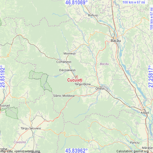
Cucuieți GPS coordinates[2]
46° 19' 38.316" North, 26° 33' 18.144" East
| Map corner | latitude | longitude |
|---|---|---|
| Upper-left | 46.81069°, | 25.85192° |
| Center: | 46.32731°, | 26.55504° |
| Lower-right: | 45.83962°, | 27.25817° |
| Map W x H: | 108×108 km | = 67.1×67.1mi |
| max Lat: | 48.23793° ⇑37.2% North |
| Cucuieți: | 46.32731° |
| min Lat: | ⇓62.8% South 43.65638° |
| min Long | Cucuieți | max Long |
| 20.31667° | 26.55504° | 29.65403° |
| W 73.8%⇐ | ⇒26.2% E |
Elevation
Elevation of Cucuieți is 325 m = 1066 ft, and this is 70.1 m = 230 ft above average elevation for this country.
| Max E: |
1278 m = 4193 ft | 29.4% |
| Cucuieți | 325 m 1066 ft | |
| Avg. | 254.9 m = 836 ft | |
Min E: |
-2 m = -7 ft | 70.6% |
See also: Romania elevation on elevation.city.
Geographical zone
Cucuieți is located in North temperate zone (between Tropic of Cancer and the Arctic Circle). Distance of this North polar circle is 2250.1 km =1398.1 mi to North.| Distance of | km | miles | from Cucuieți |
|---|---|---|---|
| North Pole | 4855.9 | 3017.3 | to North |
| Arctic Circle | 2250.1 | 1398.1 | to North |
| Tropic Cancer | 2545.2 | 1581.5 | to South |
| Equator | 5151.1 | 3200.7 | to South |


Nearby cities:
15 places around Cucuieți: (largest is in red/bold)
• Albele
10 km =6.2 mi,  65°
65°
• Berzunţi
10.1 km =6.3 mi,  36°
36°
• Bogata
3 km =1.9 mi,  174°
174°
• Brătești
6.8 km =4.2 mi,  91°
91°
• Cireșoaia
8.8 km =5.5 mi,  182°
182°
• Dofteana
3.2 km =2 mi,  248°
248°
• Dărmăneşti
7 km =4.3 mi,  308°
308°
• Hăghiac
3.3 km =2.1 mi,  238°
238°
• Larga
3.1 km =1.9 mi,  327°
327°
• Plopu
8.3 km =5.2 mi, 331°
• Poieni
5 km =3.1 mi, 169°
• Târgu Ocna
7 km =4.3 mi,  140°
140°
• Viișoara
9.6 km =6 mi,  120°
120°
• Vâlcele
4.8 km =3 mi,  133°
133°
• Ștefan Vodă
3.5 km =2.2 mi, 250°
Sources, notices
• [Note1] Compared only with cities in Romania existing in our database
• [Src1] Map data: © OpenStreetMap contributors (CC-BY-SA)
• [Src2] Other city data from geonames.org with taken over terms of usage.
• [Src3] Geographical zone / Annual Mean Temperature by Robert A. Rohde @ Wikipedia
