Cruceni geodata
Cruceni (Arad) is a populated place; located in Romania in Europe/Bucharest (GMT+3) time zone. With population of 613 people, there are 6117 cities with bigger population in this country. Compared to other cities in Romania, 56.5% of cities are located further ↓South; 98.2% of cities are located further →East and 66.5% of cities have higher elevation than Cruceni. Note1


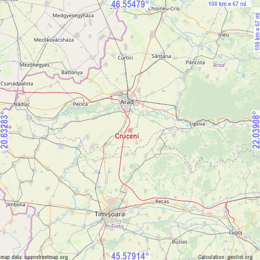
Cruceni GPS coordinates[2]
46° 4' 8.832" North, 21° 20' 9.42" East
| Map corner | latitude | longitude |
|---|---|---|
| Upper-left | 46.55479°, | 20.63283° |
| Center: | 46.06912°, | 21.33595° |
| Lower-right: | 45.57914°, | 22.03908° |
| Map W x H: | 108.5×108.5 km | = 67.4×67.4mi |
| max Lat: | 48.23793° ⇑43.5% North |
| Cruceni: | 46.06912° |
| min Lat: | ⇓56.5% South 43.65638° |
| min Long | Cruceni | max Long |
| 20.31667° | 21.33595° | 29.65403° |
| W 1.8%⇐ | ⇒98.2% E |
Elevation
Elevation of Cruceni is 141 m = 463 ft, and this is 113.9 m = 374 ft below average elevation for this country.
| Max E: |
1278 m = 4193 ft | 66.5% |
| Avg. | 254.9 m = 836 ft | |
| Cruceni | 141 m = 463 ft | |
Min E: |
-2 m = -7 ft | 33.5% |
See also: Romania elevation on elevation.city.
Geographical zone
Cruceni is located in North temperate zone (between Tropic of Cancer and the Arctic Circle). Distance of this North polar circle is 2278.8 km =1416 mi to North.| Distance of | km | miles | from Cruceni |
|---|---|---|---|
| North Pole | 4884.7 | 3035.2 | to North |
| Arctic Circle | 2278.8 | 1416 | to North |
| Tropic Cancer | 2516.5 | 1563.7 | to South |
| Equator | 5122.4 | 3182.9 | to South |


Nearby cities:
15 places around Cruceni: (largest is in red/bold)
• Alioș
12.6 km =7.8 mi,  105°
105°
• Aluniș
12.1 km =7.5 mi,  77°
77°
• Arad
12.8 km =8 mi,  353°
353°
• Felnac
15.3 km =9.5 mi,  290°
290°
• Fibiș
12.7 km =7.9 mi,  147°
147°
• Fiscut
6.3 km =3.9 mi,  132°
132°
• Frumușeni
10.4 km =6.5 mi,  69°
69°
• Fântânele
7.1 km =4.4 mi,  31°
31°
• Maşloc
11.8 km =7.3 mi, 131°
• Mândruloc
13.3 km =8.3 mi,  48°
48°
• Seceani
10.2 km =6.3 mi,  187°
187°
• Vinga
12 km =7.5 mi,  240°
240°
• Vladimirescu
11.9 km =7.4 mi,  24°
24°
• Zădăreni
11.5 km =7.1 mi,  307°
307°
• Şagu
4.6 km =2.9 mi, 242°
Sources, notices
• [Note1] Compared only with cities in Romania existing in our database
• [Src1] Map data: © OpenStreetMap contributors (CC-BY-SA)
• [Src2] Other city data from geonames.org with taken over terms of usage.
• [Src3] Geographical zone / Annual Mean Temperature by Robert A. Rohde @ Wikipedia
