Corund geodata
Corund (Harghita) is a seat of a second-order administrative division; located in Romania in Europe/Bucharest (GMT+3) time zone. With population of 6,091 people, there are 530 cities with bigger population in this country. Compared to other cities in Romania, 66.2% of cities are located further ↓South; 50.3% of cities are located further →East and 93.8% of cities have lower elevation than Corund. Note1


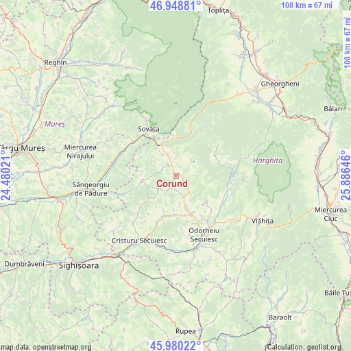
Corund GPS coordinates[2]
46° 28' 0.012" North, 25° 10' 59.988" East
| Map corner | latitude | longitude |
|---|---|---|
| Upper-left | 46.94881°, | 24.48021° |
| Center: | 46.46667°, | 25.18333° |
| Lower-right: | 45.98022°, | 25.88646° |
| Map W x H: | 107.7×107.7 km | = 66.9×66.9mi |
| max Lat: | 48.23793° ⇑33.8% North |
| Corund: | 46.46667° |
| min Lat: | ⇓66.2% South 43.65638° |
| min Long | Corund | max Long |
| 20.31667° | 25.18333° | 29.65403° |
| W 49.7%⇐ | ⇒50.3% E |
Elevation
Elevation of Corund is 589 m = 1932 ft, and this is 334.1 m = 1096 ft above average elevation for this country.
| Max E: |
1278 m = 4193 ft | 6.2% |
| Corund | 589 m 1932 ft | |
| Avg. | 254.9 m = 836 ft | |
Min E: |
-2 m = -7 ft | 93.8% |
See also: Romania elevation on elevation.city.
Geographical zone
Corund is located in North temperate zone (between Tropic of Cancer and the Arctic Circle). Distance of this North polar circle is 2234.6 km =1388.5 mi to North.| Distance of | km | miles | from Corund |
|---|---|---|---|
| North Pole | 4840.5 | 3007.7 | to North |
| Arctic Circle | 2234.6 | 1388.5 | to North |
| Tropic Cancer | 2560.7 | 1591.1 | to South |
| Equator | 5166.6 | 3210.4 | to South |


Nearby cities:
15 places around Corund: (largest is in red/bold)
• Atid
10.4 km =6.5 mi,  259°
259°
• Bisericani
11.8 km =7.3 mi,  157°
157°
• Dealu
11.6 km =7.2 mi,  129°
129°
• Goagiu
16.3 km =10.1 mi,  226°
226°
• Lupeni
9.6 km =6 mi, 164°
• Morăreni
12.3 km =7.6 mi,  166°
166°
• Ocna de Jos
7.8 km =4.8 mi,  328°
328°
• Ocna de Sus
7.2 km =4.5 mi,  340°
340°
• Praid
10 km =6.2 mi, 337°
• Simoneşti
16.1 km =10 mi,  203°
203°
• Sovata
15.7 km =9.8 mi, 325°
• Sub Cetate
16 km =9.9 mi,  98°
98°
• Sâncrai
15.1 km =9.4 mi,  137°
137°
• Vărşag
13.9 km =8.6 mi,  66°
66°
• Zetea
16.8 km =10.4 mi,  123°
123°
Sources, notices
• [Note1] Compared only with cities in Romania existing in our database
• [Src1] Map data: © OpenStreetMap contributors (CC-BY-SA)
• [Src2] Other city data from geonames.org with taken over terms of usage.
• [Src3] Geographical zone / Annual Mean Temperature by Robert A. Rohde @ Wikipedia
